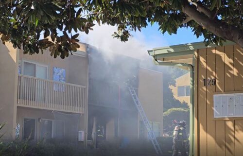
Stormy Finale
Rain chances continue into Monday on the back side of the latest storm system. Cold, but moist and unstable northwest flow will send rounds of showers and perhaps a few thunderstorms our way through late Monday. Downpours, gusty winds, small hail, and lightning possible. Snow levels drop back down to around 4kft. Conditions will then begin to dry out, though a cold air mass will remain intact for the remainder of the week. We’ll get one final rain chance with a weak system moving by late Wednesday into Thursday. Then, it may be dry for some time as a ridge of high pressure builds on the West Coast and blocks storm systems to our north for the next week or two.
AIR QUALITY: Good
***FLOOD WARNING***
… for low areas along Pacheco Creek in San Benito and Santa Clara Counties in effect until 8AM Monday.
*Flooding caused by excessive rainfall and runoff is occurring.
*Flooding of rivers, creeks, streams, and other low-lying and flood-prone locations is occurring. Numerous roads remain closed due to flooding. Streams continue to rise due to excess runoff from earlier rainfall. Low-water crossings are inundated with water and may not be passable. It will take several hours for all the water from these storms to work through local drainage systems in urban areas.
- At 234 PM PST, Emergency management reported flooding is occurring.
- Some locations that will experience flooding include...Areas in the vicinity of Shore Road, Frasier Lake Road, Lake Road, Lovers Lane, San Felipe Road near Dunneville.
Turn around, don't drown when encountering flooded roads. Most flood deaths occur in vehicles.
Be especially cautious at night when it is harder to recognize the dangers of flooding.
Stay away or be swept away. River banks and culverts can become unstable and unsafe.
**FLOOD WARNING***
… for the Salinas River from around Soledad to Monterey Bay from now until further notice
Minor flooding is occurring for the Salinas River near Spreckels.
*At 19.0 feet, Lowland agricultural areas will have minor flooding.
At 23.0 feet, A few homes near the Salinas River along the reach of the river gauge will begin to flood. River Road near Spreckels will have minor flooding.
At 24.0 feet, The lowest areas of agricultural land along the lower portions of the Salinas River will have significant flooding. River Road will have moderate flooding. Spreckels Boulevard will begin to flood.
- At 2:00 PM PST Saturday the stage was 19.9 feet.
- Recent Activity...The river stage has fallen below Minor Flood stage however flooding impacts continue and will persist into early next week.
- Forecast...The river is expected to begin rising again this afternoon and will rising above Monitor Stage of 20 ft tonight. The current forecast has the river gradually rising through the week nearing flood stage of 23 ft around midweek.
- Flood stage is 23.0 feet.
- Flood History...This crest compares to a previous crest of 20.7 feet on 01/16/1952.
Motorists should not attempt to drive around barricades or drive cars through flooded areas.
Turn around, don`t drown when encountering flooded roads. Most flood deaths occur in vehicles.
Be especially cautious at night when it is harder to recognize the dangers of flooding.
Please report observed flooding to local emergency services or law enforcement and request they pass this information to the National Weather Service when you can do so safely.
Caution is urged when walking near riverbanks. Even 6 inches of fast-moving flood water can knock you off your feet and a depth of 2 feet will float your car. Never try to walk, swim, or drive through such swift water. If you come upon flood waters, stop, turn around and go another way.
The next statement will be issued by Friday morning at 345 AM PST.
***GALE WARNING***
… for the near coastal waters from Pigeon Point to Point Pinos until 3AM Monday and from Point Pinos to Point Piedras Blancas until 3PM Monday
*Southeast winds 20 to 30 kt with gusts up to 40 kt and seas 9 to 13 ft expected.
*Strong winds will cause hazardous seas which could capsize or damage vessels and reduce visibility.
Mariners should alter plans to avoid these hazardous conditions. Remain in port, seek safe harbor, alter course, and/or secure the vessel for severe conditions.
**COASTAL FLOOD ADVISORY**
… for the immediate coast of Santa Cruz & Monterey Counties in effect until 9AM Monday.
*Minor coastal flooding expected.
*Flooding of lots, parks, and roads with only isolated road closures expected. Breaking waves can sweep people off jetties and docks, and into dangerous seas. Life-threatening swimming conditions and significant beach erosion can be expected.
*The combination of high tidal cycles, onshore winds, heavy runoff and continued rainfall will likely lead to coastal flooding in locations prone to tidal flooding.
If travel is required, allow extra time as some roads may be closed. Do not drive around barricades or through water of unknown depth. Take the necessary actions to protect flood-prone property.
Everyone should remain out of the water due to life-threatening surf conditions. Stay off of jetties, piers, and other waterside infrastructure.
**WIND ADVISORY**
… for Monterey & San Benito Counties in effect from 6PM Sunday until 4AM Monday
*Southeast winds 15 to 25 mph with gusts up to 40 mph expected.
*Given the very saturated soils, trees and branches can easily fall down in breezy to gusty conditions. Downed trees can threaten lives, cause power outages, and fall into waterways
which could exacerbate flooding conditions. Gusty winds could blow around unsecured objects.
Please alert your county officials if you see trees that look weakened from recent storms. Use extra caution when driving, especially if operating a high profile vehicle. Secure outdoor
objects.
*FLOOD WATCH*
…for the entire Central Coast and KION viewing area including Monterey, Santa Cruz and San Benito County. In effect through Monday evening.
*Excessive runoff may result in flooding of rivers, creeks, streams, and other low-lying and flood-prone locations. Creeks and streams may rise out of their banks. Flooding may occur in poor drainage and urban areas. Low-water crossings may be flooded. Storm drains and ditches may become clogged with debris. Extensive street flooding and flooding of creeks and rivers are possible. Area creeks and streams are running high and could flood with more heavy rain.
- Unsettled wet weather will continue behind the cold front that is passing over the region today. Pre-existing saturated soils will not be able to absorb excess rainfall. Urban and small stream flooding is expected along with continued flood potential on mainstem rivers through the weekend. After a brief lull early Sunday another storm will bring more rain later Sunday into Monday.
You should monitor later forecasts and be alert for possible Flood Warnings. Those living in areas prone to flooding should be prepared to take action should flooding develop.
Overnight: Light to moderate rain and wind early, then becoming mostly cloudy with isolated showers. Lows in the 40s. Gusty northwest winds at times.
Monday: Mostly cloudy with rounds of showers and thunderstorms. Storms may include lightning, small hail, gusty winds, downpours. Snow level drops to 4kft. Highs only in the low to mid 50s.
Tuesday: A few sprinkles early, then partly cloudy into the day. Patchy AM fog. Cool and breezy with highs in the low to mid 50s.
Extended: We’ll remain cool through Wednesday with another weather system bringing rain late into Thursday morning. Then, we’ll dry out and warm up into next weekend.
-------------------------------------------------------------------------
This week's normal temperatures:
--COASTAL CITIES--
LOW: 43ºF
HIGH: 62ºF
--INLAND CITIES--
LOW: 38ºF
HIGH: 62ºF
----------------------------------------------------------------------------
-The outlook from the Climate Prediction Center for January 23rd – 29th calls for the likelihood of BELOW normal temperatures and BELOW normal precipitation.
- El Niño/La Niña STATUS: La Niña Advisory
- Forecast: Weak La Niña continues through winter, becomes neutral by Spring
-Area drought status: Severe drought (D2) for southern San Benito and southeastern Monterey Counties, moderate drought (D1) for the remainder of those counties, Santa Cruz County and the KION coverage area in Santa Clara County.