
Mild Monday Afternoon
Cold and frosty is how we’ll start the work week! A dry, cold air mass will remain in place on Monday but a pair of storm systems will pay us a…
Continue ReadingErika Bratten is a weather forecaster for KION News Channel 5/46.
Cold and frosty is how we’ll start the work week! A dry, cold air mass will remain in place on Monday but a pair of storm systems will pay us a…
Continue ReadingA few more showers linger into Friday on the back side of Thursday’s storm system. A small low pressure center will rotate in Friday morning and…
Continue ReadingBack to stormy conditions on Thursday! A fast moving low pressure system will ride along the jet stream and move into our area bringing wind and…
Continue ReadingWe’ll get a break in the action on Wednesday as we catch a gap between storm systems. A fast-moving system will roll in off the Pacific early…
Continue ReadingHeavy rain likely, damaging winds possible Tuesday. An atmospheric river accompanied by a potent cold front will move through the region today.…
Continue ReadingRain is coming. The weak to moderate atmospheric river that has been stalled just to our north for the past couple of days will add moisture and a…
Continue ReadingRainy season returns! At atmospheric river will reach the West Coast on Friday and continue to hose down the coast through mid-week next week. The…
Continue ReadingExpect another cool day on Thursday with a mix of high and low clouds and a stable marine layer. High clouds will increase in advance of a weather…
Continue ReadingCool conditions will continue for the next couple of days with marine layer clouds and light onshore flow. The blocking ridge of high pressure that…
Continue ReadingCold air settles into the region for the first part of the week. Flow becomes more northwesterly Tuesday into Wednesday which will help develop a…
Continue ReadingCold air will settle in across the region in the wake of this weekend’s storm system. The low will slowly move east out of Southern California as…
Continue ReadingLight offshore flow will keep skies mostly sunny and conditions dry through midweek. We’ll see cold mornings but warm afternoons—peaking on…
Continue ReadingFriday brings changes to our weather pattern as winds shift back onshore and help push low clouds and some fog back into the forecast. Inland…
Continue ReadingFinally a pattern change in sight! Although, you might not like it! We’ve been in a general offshore pattern for the past few days which has kept…
Continue ReadingOur weather pattern remains blocked up, preventing our typical wet weather systems from reaching the West Coast. Cold mornings, mild afternoons, and…
Continue ReadingCold mornings, mild afternoons, and extremely dry weather will continue for the next few days (at least). Our weather pattern remains blocked up,…
Continue ReadingDry, mostly sunny weather persists. Afternoon highs will be comfortable, remaining above average for this time of year. But, mornings will continue…
Continue ReadingDry weather will continue on Friday, though we’ll have a few wind shifts to deal with. A brief burst of southerly flow will potentially bring some…
Continue ReadingKeep those sunglasses handy! There will be plenty of sunshine to enjoy over the next several days. Mornings will be cool, but afternoons warm with…
Continue ReadingWith a dry air mass in place, expect cool mornings and warm afternoons for the next few days. Conditions will be pleasant across the Central Coast,…
Continue ReadingA major wind storm has developed across portions of the state. We’ll only catch the edge of it here around the Monterey Bay Area. An area of low…
Continue ReadingDry conditions are expected for the next week as our weather pattern will be characterized by dominating high pressure and offshore winds. Initially,…
Continue ReadingRain returns to the Monterey Bay Area on Friday as a frontal system moves through. The weak warm front will arrive first just after dawn with some…
Continue ReadingTemperatures will warm on Thursday as high pressure amplifies over the region. Warming will be aided by offshore flow early in the day, with many…
Continue ReadingCool, dry conditions will finish off the year. Passing storm systems to our north will bring some mid to upper level clouds over the next couple of…
Continue ReadingA cold and drying air mass is settling in behind Sunday’s cold front that brought the Central Coast rain. Monday will be beautiful, just cool and…
Continue ReadingRain chances will continue in the coming days as we sit on the edge of an atmospheric river. After morning rain, it sloshed back north for Friday…
Continue ReadingThe main rain maker this morning has exited the Central Coast, but few scattered showers may linger in the post-frontal environment and an additional…
Continue ReadingA mix of clouds and sunshine this Monday with damp, mild conditions. Drizzle possible throughout the day with light rain returning tonight. A…
Continue ReadingThe warming trend will come to an end along with the clear, sunny weather. High pressure will begin to break down Friday and thus a transition day…
Continue ReadingWarm, offshore flow continues on Thursday with well-above normal temperatures for most areas. High pressure will begin to break down, however. Friday…
Continue ReadingPleasant weather with warm temps and dry conditions, will remain the story for the rest of the work week as the upper level ridge builds.…
Continue ReadingWe’ll get a break in the wet weather for a few days as high pressure builds in from the south. Temperatures will be above normal through the end of…
Continue ReadingRain returns to the region on Monday, but this time, the weather system will be pretty weak. Light to briefly moderate rain will arrive around the…
Continue ReadingMid-week brings little change. Though most won’t notice, there will be a slight decrease in temperatures on Wednesday afternoon. Inland areas will…
Continue ReadingInland heat will continue for the next few days with slightly warmer than normal but comfortable temperatures on the coast. The big monsoonal ridge…
Continue ReadingTemperatures head back upward starting Monday—both for the coast and inland areas! High pressure to our east pushes back into California and will…
Continue ReadingInland areas will experience bouts of heat over the coming week. The massive monsoonal high to our east is trying to migrate to the west and will…
Continue ReadingHot weather will return to inland areas over the next few days as a ridge of high pressure nudges in from the east. The ridge will also compress the…
Continue ReadingAnother warm up on the way! The upper level low sitting to our northwest has started to move east. This will now allow the ridge of high pressure,…
Continue ReadingWe’re Sandwiched between two weather systems, the influence of a trough of low pressure to our northwest is the strongest for now. The marine layer…
Continue Reading
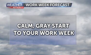
No heat alerts, no lightning threat. We head into the work week on the quiet side, which I’m sure most are grateful for. High pressure remains well…
Continue ReadingWe have one more hot inland day before the weather changes this weekend. Friday will really be a transition day and even while inland temperatures…
Continue ReadingTwo more days of inland heat are expected before we cool down this weekend. Though temps will peak this afternoon. Coastal temperatures will also…
Continue ReadingTemperatures head upward for most areas on Wednesday after brief cooling on Tuesday. High pressure to our east nudges back in, leading to that…
Continue ReadingTuesday will bring an overall cool down to the Central Coast, as the strong ridge of high pressure that brought all-time record heat to parts of…
Continue ReadingExcessive heat will continue for inland areas over the next few days as we bathe in cooler, cloudier weather along the coast. As the strong ridge of…
Continue ReadingExcessive heat and critical fire danger will continue for inland valleys and the higher terrain into the weekend. The center of the massive ridge of…
Continue ReadingExcessive heat and critical fire danger will continue to dominate the forecast through the weekend. High pressure continues to build in from the…
Continue ReadingExcessive heat and critical fire danger will dominate the forecast through the Fourth of July holiday all the way through the weekend. High pressure…
Continue Reading