
All Good Things…
SALINAS, Calif. (KION) – Weak low pressure aloft will stick around for the next few days. The marine layer will remain in place on the coast…
Continue Reading SALINAS, Calif. (KION) – Weak low pressure aloft will stick around for the next few days. The marine layer will remain in place on the coast…
Continue Reading
SALINAS, Calif. (KION) – Weak low pressure aloft will stick around for the next few days. The marine layer will remain in place on the coast…
Continue Reading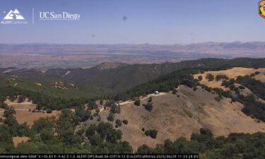
SALINAS, Calif. (KION) – An area of low pressure will move over us and get stuck for a couple of days, keeping the marine layer deep but…
Continue Reading
SALINAS, Calif. (KION) – The marine layer will deepen a bit on Sunday as a cut-off low to our southwest moves closer to us. This will send…
Continue Reading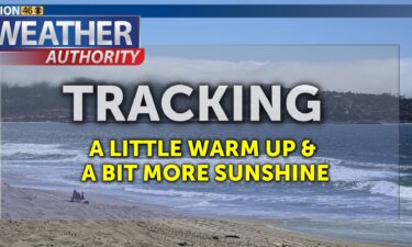
SALINAS, Calif. (KION) – We remain in a fairly stable summer weather pattern, but there will be a few fluctuations here and there. Thursday…
Continue Reading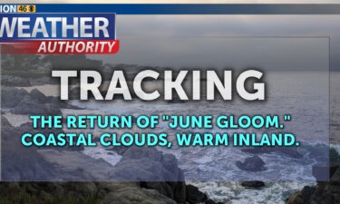
SALINAS, Calif. (KION) – The marine layer will begin to compress on Wednesday as high pressure nudges in from the southwest. All inland areas…
Continue Reading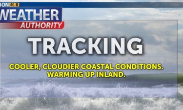
SALINAS, Calif. (KION) – Cooler, cloudier coastal weather will continue for the next few days with a stable, moist marine layer. Inland areas…
Continue Reading
SALINAS, Calif. (KION) – Cooler temperatures are expected for coastal cities as we head into the work week. Various factors are leading to a…
Continue Reading
SALINAS, Calif. (KION) – Windy conditions slowly taper off over the next day or so as the weather pattern stabilizes. The trough that was…
Continue ReadingSALINAS, Calif. (KION) – Cooler, windier weather can be expected on Thursday as a trough of low pressure digs down the West Coast. Some inland…
Continue ReadingSALINAS, Calif. (KION) – Temperatures head upward into Wednesday as a strong ridge of high pressure surges in from the south. It will compress the…
Continue Reading
SALINAS, Calif. (KION) – Tuesday is trending sunnier as dry northwest flow continues. That flow could be gusty at times on the exposed coast and in…
Continue Reading
SALINAS, Calif. (KION) – We’re in a fairly quiet summer pattern, but that doesn’t mean we won’t see a few ups and downs. A weak trough will…
Continue ReadingSALINAS, Calif. (KION) – Our stable summer pattern will continue into the weekend, though slightly warmer & sunnier conditions can be expected.…
Continue ReadingSALINAS, Calif. (KION) – Not much change in the forecast in the coming days. We’re still leaning toward slightly warmer coastal temperatures as we…
Continue ReadingSALINAS, Calif. (KION) – We’re stuck! Stuck in a quiet pattern that just so happens to support a moderately deep and stable marine layer. While…
Continue Reading
SALINAS, Calif. (KION) – Coastal clouds may stick around for the next few days as we remain in a somewhat stable weather pattern. The hot ridge to…
Continue Reading
SALINAS, Calif. (KION) – Coastal clouds may stick around for the next few days as we remain in a somewhat stable weather pattern. A strong, hot ridge…
Continue ReadingSALINAS, Calif. (KION) – Temperatures will remain on the cool side Thursday and Friday as a stable marine layer keeps clouds on the coast. Some…
Continue ReadingSALINAS, Calif. (KION) – Seasonable to slightly cool temperatures will persist into Wednesday. A cut off area of low pressure to our south will…
Continue ReadingSALINAS, Calif. (KION) – Seasonable temperatures continue for the most part on Tuesday. A cut off area of low pressure will sit to our south…
Continue Reading
SALINAS, Calif. (KION) – Temperatures drop for inland areas on Sunday as the big hot ridge weakens and a cut off low to our south slowly moves…
Continue Reading
SALINAS, Calif. (KION) – The marine layer will continue to deepen into Monday as a trough digs in from the north. The deepening processes may help…
Continue ReadingSALINAS, Calif. (KION) – Temperatures increase on Thursday—by a few degrees on the coast and 5-10ºF inland, then soar higher on Friday!…
Continue Reading
SALINAS, Calif. (KION) – Temperatures will remain seasonable to slightly cool through mid-week. A weak cut-off low will be joined by another trough…
Continue Reading
SALINAS, Calif. (KION) – A weak system passes by overnight keeping clouds and some wind in the forecast. Some drizzle can’t be ruled out. A…
Continue Reading
SALINAS, Calif. (KION) – A (dry) trough will pass by into Monday/Tuesday which will cool inland areas and keep coastal areas seasonable. Winds may…
Continue Reading
SALINAS, Calif. (KION) – Warmer temperatures expected for most areas on Sunday as sunshine increases around the region. A (dry) trough will pass by…
Continue ReadingSALINAS, Calif. (KION) – Temperatures will cool Thursday-Friday as a weak trough passes over the West Coast. By Friday, we should return to…
Continue ReadingSALINAS, Calif. (KION) – Inland temperatures peak on Wednesday—it will be warmer on the coast too—as the axis of the high pressure ridge passes…
Continue ReadingSALINAS, Calif. (KION) – Temperatures will cool slightly on Tuesday in the wake of a weak frontal boundary that moved through late Monday night.…
Continue ReadingSALINAS, Calif. (KION) – Temperatures continue to head upward on Monday as high pressure nudges in from the west. The wind machine will keep going,…
Continue ReadingSALINAS, Calif. (KION) – High pressure quickly rebuilds starting Sunday, sending temperatures back upward. We won’t be rid of the wind, however.…
Continue ReadingTemperatures fall Saturday as weather system moves south into the Great Basin. While its rains will miss us, clouds and wind along with the…
Continue ReadingA weak disturbance will pass by overnight into Friday morning with passing clouds and maybe a sprinkle in the mountains. Gusty winds will follow on…
Continue ReadingSALINAS, Calif. (KION) – The ridge will build back in on Wednesday and while inland areas will begin to warm back up, the stabilization of…
Continue ReadingSALINAS, Calif. (KION) – After a very warm Monday, temperatures fall back down on Tuesday! An area of low pressure will retrograde out of the…
Continue ReadingSALINAS, Calif. (KION) – We’re in for a bit of a temperature roller coaster in the coming days as we flipflop between offshore and onshore flow and…
Continue Reading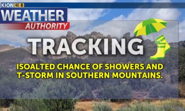
SALINAS, Calif. (KION) – Cool and cloudy conditions will persist along the coast into Friday. Winds will begin to pick up as a deep trough…
Continue ReadingSALINAS, Calif. (KION) – Expect an overall cool-down on Wednesday, though temperatures won’t change too much on the coast. The north side of…
Continue ReadingSALINAS, Calif. (KION) – Warmer, drier weather continues into Tuesday as high pressure builds in. Temperatures rise about 8ºF over the area,…
Continue ReadingSALINAS, Calif. (KION) – Warmer, drier weather expected as we head into the work week. High pressure will build in from the southwest warming…
Continue ReadingSALINAS, Calif. (KION) – The chance of rain returns as we approach the weekend. Thursday will be dry, however, outside of any coastal drizzle. A…
Continue ReadingSALINAS, Calif. (KION) – Cooler, cloudier weather expected through mid-week as deep onshore flow will keep clouds in the picture. The deepening…
Continue ReadingSALINAS, Calif. (KION) – Expect a cooling trend through mid-week. A trough of low pressure develops on the West Coast, cooling temperatures aloft…
Continue Reading
SALINAS, Calif. (KION) – Monday will be the warmest day of the week for most of us as high pressure off to the southwest exerts its strongest…
Continue ReadingSALINAS, Calif. (KION) – High pressure begins to nudge in from the southwest Friday which will warm temperatures a bit—especially…
Continue ReadingSALINAS, Calif. (KION) – Cool and slightly damp conditions will continue into Thursday as a cut-off slow slowly passes by to our south. While…
Continue ReadingSALINAS, Calif. (KION) – The best chance of rain over the area will be on Wednesday, but it is still a relatively low chance. Even lower, but…
Continue ReadingSALINAS, Calif. (KION) – Cooler, unsettled weather will be with us through mid-week. A cut-off low will slowly pass over the region Tuesday…
Continue Reading