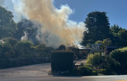
Mild Monday Afternoon
Cold, dry air will settle in overnight behind this weekend’s weather system leading to frost for higher valleys and patchy frost in the lower valleys approaching the coast. Once the sun comes up, rapid warming will begin with seasonable highs expected. The next weather system will move by to our northeast Tuesday and the tail end of its cold front will reach our area. We may see a bit of drizzle just ahead of the front, but it looks less impressive than the last system. Gusty northerly winds are likely to follow mid-week, then taper off toward the end of the week. All in all, expect seasonable to slightly cool high temperatures into next weekend.
AIR QUALITY: GOOD
Monday: Sunny and warmer with coastal highs in the upper 60s to low 70s and low to mid 70s inland. Light offshore winds early will switch to a sea breeze in the afternoon. Some low cloudcover/fog possible on the south side of the bay late. Smoke from a controlled burn in the Gabilan Range will be visible in the afternoon.
Overnight: Low clouds/fog possible on the coast. Slightly warmer with coastal lows in the 40s and 30s-40s inland
Tuesday: Partly cloudy with low clouds on the coast and increasing high clouds. Drizzle possible late. Cooler, with highs mainly in the 60s on the coast and 60s to 70s inland. Winds pick up late.
Extended: Gusty northerly winds with cool, dry conditions Wednesday, then winds ease and temperatures level off just below normal for the rest of the week.
-------------------------------------------------------------------------
This week's normal temperatures:
--COASTAL CITIES--
LOW: 49ºF
HIGH: 70ºF
--INLAND CITIES--
LOW: 45ºF
HIGH: 77ºF
----------------------------------------------------------------------------
-The outlook from the Climate Prediction Center for October 31st – November 6th calls for the likelihood of near normal temperatures and near normal precipitation.
- El Niño/La Niña STATUS: La Niña Advisory
- Forecast: Weak La Niña into the Winter
-Area drought status: “Severe Drought” for most of the viewing area with “Extreme Drought” in southern San Benito and southeastern Monterey Counties. The southeastern third of San Benito County has been upgraded to “Exceptional Drought”


