Hurricane Hilary could dump over a year’s worth of rain on parts of the Southwest
Originally Published: 18 AUG 23 01:12 ET Updated: 18 AUG 23 11:48 ET By Mary Gilbert and Elizabeth Wolfe, CNN
(CNN) — Concern is growing Hurricane Hilary will unleash a prolific amount of flooding rainfall on the southwestern US and parts of California as it makes a rare move over the region Sunday and into early next week, triggering the first ever tropical storm watch for California.
Hilary could dump more than a year’s worth of rain in parts of three states: California, Nevada and Arizona. Because of the threat, parts of California face a rare high risk for excessive rainfall. This Level 4 of 4 threat is the first to ever be issued for this part of Southern California.
Hilary was a powerful Category 4 hurricane churning about 400 miles south of Cabo San Lucas, Mexico, Friday morning with sustained winds of 145 mph with stronger gusts, the National Hurricane Center said.
The storm underwent incredible rapid intensification Thursday into Friday, strengthening from a tropical storm to a Category 4 hurricane in just 24 hours. Hilary is forecast to remain a Category 4 as it approaches Mexico’s Baja California peninsula through Saturday.
There is some potential for Hilary to become the first Category 5 hurricane this season briefly before it enters colder water and loses some strength.
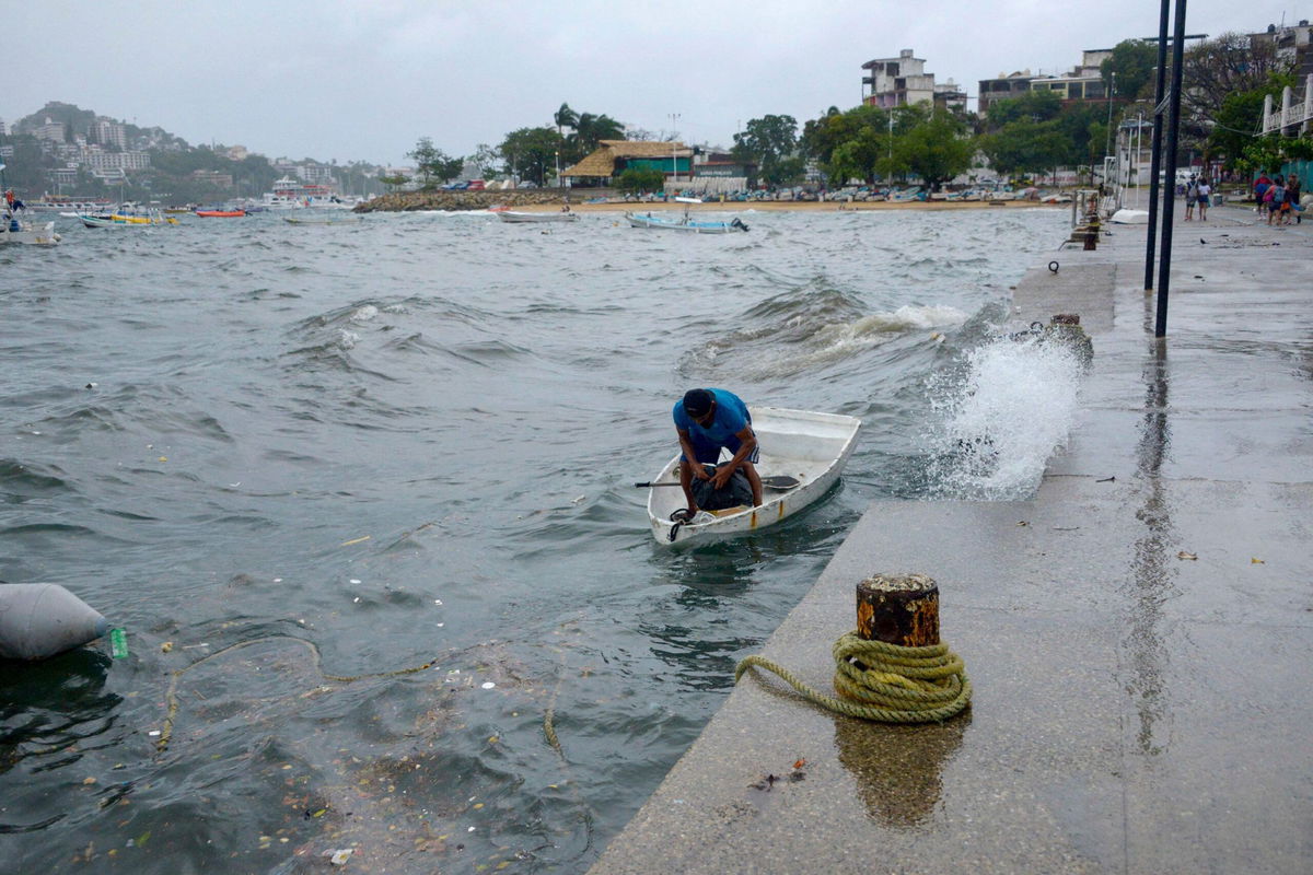
Officials have issued hurricane watches, tropical storm watches and tropical storm warnings for Baja California and northwest Mexico as Hilary’s center approaches the country through the weekend.
There remains a wide range of outcomes for the strongest winds in the US as the storm moves north over the next couple of days. Small deviations in the hurricane’s track could change the forecast for the most intense rain and wind.
Hilary is more likely to make landfall in Mexico and cross into California, but if it makes landfall in California as a tropical storm, it would be the first such storm to make landfall in California in nearly 84 years, according to data from the National Oceanic and Atmospheric Administration.
The first ever tropical storm watch was issued for parts of Southern California Friday morning, the National Hurricane Center said. It extends from the California/Mexico border to the Orange County/Los Angeles County line.
“The threat of significant wind impacts continues to increase for northern portions of the Baja California Peninsula and the Southwestern United States, especially in areas of mountainous terrain,” the hurricane center said Thursday night.
Southwest braces for significant flooding
Hilary is expected to substantially weaken before reaching Southern California and parts of the Southwest but, regardless of its strength, the storm will enhance heavy rainfall and increase flooding danger.
Heavy rainfall is expected to begin impacting the Southwest Saturdayand through early next week, with the most intense downpours likely on Sunday and Monday.
It’s hard to overstate how big of a deal the high risks for excessive rainfall is. High risks are issued on fewer than 4% of days per year on average, but are responsible for 83% of all flood-related damage and 39% of all flood-related deaths, research from the Weather Prediction Center shows.
Southern parts of California and Nevada could receive 3 to 5 inches of rain with isolated amounts of up to 10 inches. Rainfall of 1 to 3 inches is expected across central parts of those states as well as across western Arizona and southwest Utah.
Thanks to Hilary, “multiple years’ worth of precipitation could potentially fall in some of the driest parts of California,” Daniel Swain, a climate scientist at the University of California at Los Angeles, said Wednesday.
Among those spots is Death Valley, California, the hottest place on Earth. Death Valley typically receives about 2 inches of rain across an entire year, according to NWS data. Moisture from Hilary could unleash enough rain to give Death Valley 1 to 2yearsworth of rainfall in a single day. And Las Vegas could get 2 to 4 inches of rain. It only averages 3.75 inches of rain a year.
Prolonged rain may oversaturate the ground and overwhelm waterways, potentially worsening the flood threat.
Weekend flood watches have been issued across southern California stretching from San Diego to Los Angeles as residents brace for potential deluges.
The National Weather Service in Los Angeles has also warned of the potential for dangerously high surf, rip currents and coastal flooding.
Tropical activity ramping up in the Atlantic
Not to be outdone by the East Pacific, the Atlantic is gearing up for a dramatic increase in tropical activity in the coming days. Four separate areas of concern stretch across the entire basin from west of the Cabo Verde Islands to the Gulf of Mexico.
Of most immediate concern to the United States is an area in the extremely warm Gulf of Mexico where atmospheric conditions can come together to support tropical development next week. An area of low pressure may slowly organize in the basin, strengthen and acquire tropical characteristics over the western Gulf by the middle of the week.
Three separate areas of concern are in the tropical Atlantic. An area of disorganized showers and thunderstorms west of the Cabo Verde Islands may organize into a tropical depression over the weekend and could strengthen further into a tropical storm. Another area of disturbed weather just to the west could become a tropical depression by early next week. Yet another area has a low chance of gaining tropical characteristics near the Lesser Antilles.
The-CNN-Wire
™ & © 2023 Cable News Network, Inc., a Warner Bros. Discovery Company. All rights reserved.
