State-of-the-art drones used to track vegetation fires before they become wildfires
Originally Published: 21 JUL 23 12:59 ETBy WEB STAFF
Click here for updates on this story
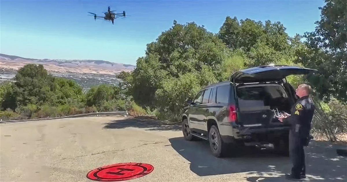
ALAMEDA COUNTY, California (KPIX) -- The Alameda County Sheriff's Department is using state-of-the-art drones to gain an edge in challenging terrain this fire season.
After our extremely wet winter weather, the Bay Area and surrounding areas saw a lot of wild grasses sprout grow and cover vast amounts of terrain. Now, that brush and grass may dry out and pose an increased wildfire risk.
"Means a lot to provide some sort of security level for the guys on the ground who are doing all the dangerous work where I'm, you know, maybe a couple blocks quarter mile away, just giving them real-time information on what to expect what's around the corner, that that kind of stuff," said Alameda County Sheriff Deputy John Cota.
After years in the airline industry, Cota shifted his aerial skills to public service. Today he leads the drone unit which is forming a unique but crucial inter-agency relationship to deploy this military-grade technology.
"When we're on top of the ridge, because it's downslope and we can't get to it," Cota explained. "We're able to fly the drone around that perimeter and give them the coordinates and then they can take this back to the office the coordinates back to the office and produce a map and then calculate some sort of strike team or another plan for the next shift coming on and how to attack the fire."
It's teamwork like this with Alameda County Fire Captain Eric Truax that has become an invaluable asset in the fight against wildfires. Equipped with thermal imaging cameras, advanced sensors, and real-time data processing capabilities, they provide a bird's eye view of a complex fire, allowing firefighters to make faster and more informed decisions.
"Sometimes you have an actual visual of what's going on and sometimes you don't, right? So, this gives us real-time information. And a big advantage like he said is we're able to look at fire progress, do our fire behavior calculations, and then assess how long it'll take to get resources in there to make a stop or to protect that structure," said Truax. "And then we can build our plan based on that, where we need to allocate our resources and the amount of time we have because you know everything there's information lag, right? And it takes time to get information."
Cota reminded CBS News Bay Area how response time is critical in an emergency, but safety is paramount, and that the deployment of these drones could make a lifesaving difference.
"We would rather send in one, a canine, or two, this technology versus sending in a human being and it protects the citizens, and it protects the guys on the ground," explained Cota.
As extreme weather events ignite more severe wildfires each season, this integration of police drones is providing a unifying hope to get ahead of the flames as they come.
However, a word of caution: firefighters are warning the public not to fly their personal drones in wildfire areas. It forces firefighters to ground their drones, as well as helicopters and planes used to fight the fire.
Please note: This content carries a strict local market embargo. If you share the same market as the contributor of this article, you may not use it on any platform.
The-CNN-Wire
™ & © 2023 Cable News Network, Inc., a Warner Bros. Discovery Company. All rights reserved.