Little Warmer, Little Sunnier
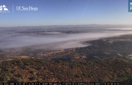
The upcoming week will have a sunnier outlook. Generally, we’ll remain in northwesterly flow which will keep the clouds from taking over day to day. The marine layer will remain present at the coast, it just won’t be as stable and the air will be dryer. Both of those factors work against a thick, unmoving cloud layer. We’re still likely to see clouds in the overnight. The northwest flow will have its downside in occasionally gusty winds.
AIR QUALITY: Good to Moderate
Monday: From partly cloudy to mostly sunny with only a few low clouds on the coast and a few cumulus over the hills in the afternoon. Highs in the 60s on the coast—warmest on the north side of the bay—and upper 60s to around 80ºF inland. Gusty northwesterly onshore and up-valley winds in the afternoon and early evening.
Overnight: Low clouds will be on the increase filling the bay and nearby valleys. Not as widespread as Monday morning. Partly to mostly cloudy near the coast, partly cloudy to mostly clear inland. Lows will be a touch cooler with slightly clearer conditions, mid to upper 40s at the coast, upper 30s to low 40s inland.
Tuesday: A few clouds in the morning, then becoming mostly sunny and warmer with highs in the 60s to low 70s on the coast and widespread 70s-80s inland. Gusty northwesterly onshore and up-valley winds in the afternoon and early evening.
Extended: The overall pattern won’t change much into the weekend—we’ll be tracking some minor perturbations—the first being the ridge strengthening to our west and warming us up through mid-week. Then, a wave on the back side of the trough over the Western U.S. will cool us into the weekend. As of now, no rain is in the forecast and no major drizzle events are evident.
*Note: Any alerts from the National Weather Service in Monterey will be noted in italics above. Alerts may be edited for brevity or local clarification (in parenthesis).
-----------------------------------------------------------------------
This week's normal temperatures:
--COASTAL CITIES--
LOW: 50ºF
HIGH: 66ºF
--INLAND CITIES--
LOW: 47ºF
HIGH: 76ºF
--------------------------------------------------------------------------
-The outlook from the Climate Prediction Center for May 27th - June 2nd calls for the likelihood of BELOW normal temperatures and near normal precipitation.
- ENSO (El Niño/La Niña) STATUS: El Niño Advisory, La Niña Watch
- ENSO Forecast: Transition from El Niño to neutral soon and then to La Niña by summer.
-Area drought status: Currently drought-free
-Monterey Bay Sea Surface Temperature* as of May 19th: 56.6ºF
(Historic May AVG: 55.8ºF)
*average of three buoys


