Coastal Clouds and Inland Heat
SALINAS, Calif. (KION) - Coastal clouds may stick around for the next few days as we remain in a somewhat stable weather pattern. The hot ridge to our north moves south as cut-off upper level low over us is reabsorbed into the flow. The ridge will briefly join with a building ridge to our south, but then immediately flatten out by mid-week. The impacts will be inland warming Monday/Tuesday with a stable marine layer keeping clouds and cooler temperatures at the coast.
Air Quality: Good
Overnight: Widespread low clouds for the coast and major valleys. Patchy fog in the hills. Can’t rule out a spritz of drizzle. Low in the 50s for overcast areas, a few 40s for clear inland valleys.
Monday: Overcast for the coast and nearby valleys early, then clouds retreating to the coast but lingering over coastal cities with some clearing on the north side of the bay. A touch warmer on the coast with highs in the 60s to around 70ºF and warmer inland with highs ranging from the mid-70s to upper 90s. Breezy onshore winds the river mouths then windy up valleys late in the day.
Tuesday: Low clouds linger on the coast again with highs in the 60s to low 70s. Inland areas remain warm and mostly sunny with highs in the 70s to around 100ºF. Breezy onshore winds at the river mouths becoming windy up valleys late in the day.
Extended: The ridge flattens out by mid-week, getting us into more of a progressive pattern. Inland areas will cool back down closer to normal, but deeper mixing in the marine layer will allow for more sunshine and perhaps slightly warmer temperatures. Winds will pick up too, especially from Wednesday on.
------------------------------------------------------------------------
This week's normal temperatures:
--COASTAL CITIES--
LOW: 51ºF
HIGH: 67ºF
--INLAND CITIES--
LOW: 48ºF
HIGH: 78ºF
-------------------------------------------------------------------------
The outlook from the Climate Prediction Center for June 16th – 22nd calls for the likelihood of ABOVE normal temperatures and BELOW normal precipitation.
- ENSO (El Niño/La Niña) STATUS: Neutral
- ENSO Forecast: Neutral conditions persist through summer & possibly into next winter.
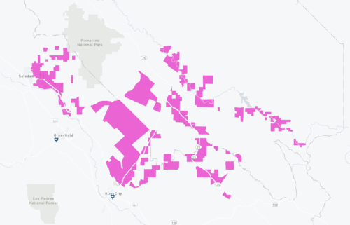
-Area drought status: Abnormally dry for portions of southern San Benito and southeastern Monterey Counties. Drought-free for the remainder of the KION coverage area.
-Monterey Bay Sea Surface Temperature as of June 9th : N/A (avg. of 7 buoys) [Historic June Avg. SST: 56.7ºF]


