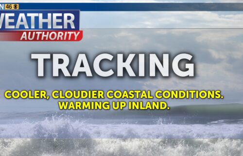
Cold Air Settles In
Cold air will settle in across the region in the wake of this weekend’s storm system. The low will slowly move east out of Southern California as the day progresses Monday. Light northeasterly flow will slowly dry the air mass which will also warm slightly through mid-week. Both highs and lows will be below normal for the next few days.
Air Quality: Good to Moderate
Overnight: A few showers possible in the south, otherwise decreasing clouds with a few low clouds/fog possible in the valleys. Chilly with lows in the 30s to low 40s on the coast and 20s to mid-30s inland.
***FREEZE WARNING***
…for all of Monterey County except the coast, all of San Benito County, and the Santa Clara Valley and Diablos in South Santa Clara County in effect from 1AM Monday until 9AM Monday and then a FREEZE WATCH in effect late Monday through Thursday morning.
*For the Freeze Warning, sub-freezing temperatures as low as 28 expected. For the Freeze Watch, sub-freezing temperatures as low as 30 possible.
*Cold conditions will be hazardous to sensitive populations such as unhoused individuals. Cold Conditions can lead to hypothermia with prolonged exposure. Frost and freeze conditions could kill crops, other sensitive vegetation and possibly damage unprotected outdoor plumbing.
Take steps now to protect tender plants from the cold.
To prevent water pipes from freezing; wrap or drain or allow them to drip slowly.
**FROST ADVISORY**
…for coastal Monterey County, coastal Santa Cruz County except the “north coast” and the Santa Cruz Mountains in effect from 1AM Monday until 9AM Monday. A FREEZE WATCH will then be in effect late Monday through Thursday morning.
*For the Frost Advisory, temperatures as low as 32 will result in frost formation. For the Freeze Watch, near-freezing temperatures as low as 32 possible.
*Frost and freeze conditions could kill crops, other sensitive vegetation and possibly damage unprotected outdoor plumbing. Cold conditions will be hazardous to sensitive populations such as unhoused individuals. Cold Conditions can lead to hypothermia with prolonged exposure.
Take steps now to protect tender plants from the cold.
To prevent water pipes from freezing; wrap or drain or allow them to drip slowly.
Monday: Mostly sunny and a bit cool with highs in the upper 50s to around 60ºF. Light winds.
Tuesday: Cold in the morning with widespread frost inland and patchy frost to the coast. Highs in the 50s to low 60s. A few low clouds possible on the coast late.
Extended: Temperatures remain cool through mid-week with cold, frosty mornings and cool afternoons. Clouds will be on the increase late in the week as a ridge of high pressure to our west breaks down, potentially allowing for a more active storm track into the weekend. There is a lot of variability in the models at this point, but it is worth watching!
*Note: Any alerts from the National Weather Service in Monterey will be noted in italics above. Alerts may be edited for brevity or local clarification
-----------------------------------------------------------------------
This week's normal temperatures:
--COASTAL CITIES--
LOW: 43ºF
HIGH: 61ºF
--INLAND CITIES--
LOW: 38ºF
HIGH: 62ºF
--------------------------------------------------------------------------
-The outlook from the Climate Prediction Center for February 3rd – 9th calls for the likelihood of BELOW normal temperatures and ABOVE normal precipitation.
- ENSO (El Niño/La Niña) STATUS: La Niña Advisory
- ENSO Forecast: La Niña persists into spring, then transitions to neutral by summer.
- Area drought status: Abnormally dry for San Benito County, northeastern Monterey County and eastern Santa Clara County. Drought-free elsewhere
- Monterey Bay Sea Surface Temperature as of January 27th : 53.0ºF (avg of 6 buoys) [January Average: 54.7ºF]