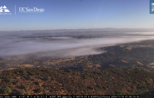
Quiet Weekend
High pressure builds back in for the weekend, resulting in the first warm, dry weekend in several weeks. We’ll have a few low clouds near the coast at times, but generally expect sunshine and seasonable to slightly warm temperatures. A trough will approach from the west staring into the work week which will usher in deeper onshore flow, cooling the coast initially with inland areas following by Tuesday. The cold trough will pass by just after mid-week, but interestingly, a weather system trailing the trough may have the best chance of rain this coming Friday. Before then, there is just a slight chance of drizzle or perhaps a few showers.
AIR QUALITY: Good
Saturday: Low clouds in the morning, then clearing with mostly sunny skies throughout the day. Warmer, with coastal highs in the 60s to around 70ºF. Inland highs, in the mid 70s to around 80ºF. Gusty northwesterly onshore winds in the afternoon.
Sunday: Mostly sunny with a few high clouds passing through and a few low clouds on the coast. Slightly warm with coastal highs in the 60s to low 70s and 70s to low 80s inland. Breezy west-northwesterly winds late in the day.
Extended: We’ll transition to cooler weather starting early next week. First, on the coast with an increase in low clouds Monday and potentially some drizzle. There is also a slight chance of an isolated shower or thunderstorm over the Diablo Range Monday afternoon. Expect cooler, partly cloudy weather across the region Tuesday through Thursday with a slight chance of drizzle or a light shower. A better chance of rain will arrive on Friday, though it still appears to be generally low impact.
*Note: Any alerts from the National Weather Service in Monterey will be noted in italics above. Alerts may be edited for brevity or local clarification (in parenthesis).
------------------------------------------------------------------------
This week's normal temperatures:
--COASTAL CITIES--
LOW: 47ºF
HIGH: 64ºF
--INLAND CITIES--
LOW: 42ºF
HIGH: 71ºF
--------------------------------------------------------------------------
-The outlook from the Climate Prediction Center for April 26th – May 2nd calls for the likelihood of BELOW normal temperatures and ABOVE normal precipitation.
- ENSO (El Niño/La Niña) STATUS: El Niño Advisory, La Niña Watch
- ENSO Forecast: Transition from El Niño to neutral by Spring and then to La Niña by summer.
-Area drought status: Currently drought-free


