Sliding Into A More Active Weather Pattern
Temperatures cool down on Friday as an upper level low passes to our south. We’ll see quite a bit of cloudcover streaming in from the south and the return of onshore flow. Both will impede temperatures. Conditions are likely to stay mostly dry. There is a very slight chance of a shower from Monterey Bay southward, and even more so down along the San Luis Obispo County line. The next system then arrives very early on Sunday morning.
Air Quality: Good
Overnight: High clouds streaming in from the south with occasional gaps. Mild, with lows in the 40s to low 50s.
Friday: Partly cloudy with an isolated shower or two possible south of Monterey Bay, mainly along the San Luis Obispo County line. Cooler with onshore flow and coastal highs in the 60s to low 70s. Low to mid 70s expected inland. Breezy up valleys late in the day.
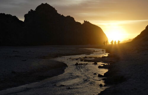
*Beach Hazards Statement*
…for north and west-facing coastal areas of Monterey & Santa Cruz in effect from Friday evening through Saturday morning.
*Westerly swell 7 feet with swell periods 16 seconds with occasional breakers to 12 feet then swell periods up to 20 seconds resulting in breakers near 14 feet Friday night and Saturday morning.
…and for south-facing coastal areas of Santa Cruz County in effect from Friday evening through Monday evening.
*Westerly swell 7 feet with swell periods 16 seconds with occasional breakers to 12 feet except swell periods up to 20 seconds resulting in breakers near 14 feet Friday night and
Saturday morning.
*Dangerous swimming and surfing conditions and localized beach erosion. Sneaker waves can unexpectedly run significantly farther up the beach than normal, including over rocks and jetties. These waves can suddenly knock people off their feet and quickly pull them into the cold ocean waters, where currents will be stronger than normal. These waves can also carry driftwood logs and other debris.
Remain out of the water to avoid hazardous swimming conditions.
**HIGH SURF ADVISORY**
... for north and west-facing coastal areas of Monterey & Santa Cruz Counties in effect from 9AM Saturday until 9PM Monday
*Westerly swell increasing to 10 to 11 feet with swell periods 17 seconds resulting in breakers up to 19 feet from Saturday morning through Monday evening.
*Dangerous swimming and surfing conditions and localized beach erosion. Sneaker waves can unexpectedly run significantly farther up the beach than normal, including over rocks and jetties. These waves can suddenly knock people off their feet and quickly pull them into the cold ocean waters, where currents will be stronger than normal. These waves can also carry driftwood logs and other debris.
Inexperienced swimmers should remain out of the water due to dangerous surf conditions.
Remain out of the water to avoid hazardous swimming conditions.
Saturday: Low clouds hang around the coast for most of the day with a few gaps. Otherwise mostly sunny for inland areas. Cooler, with coastal highs in the upper 50s to low 60s and 60s to low 70s inland. Clouds increase late with a chance of rain around midnight.
Extended: The next, stronger weather system arrives on Sunday with rounds of showers and the potential for thunderstorms. Temperatures will be much cooler with almost all areas only topping out in the 50s. Snow will be possible above 4,000ft in elevation. We’ll break into showers on Monday as the system moves out. Then, there’s some uncertainty next week, but additional rain chances will be possible through mid-week.
*Note: Any alerts from the National Weather Service in Monterey will be noted in italics above. Alerts may be edited for brevity or local clarification.
-----------------------------------------------------------------------
This week's normal temperatures:
--COASTAL CITIES--
LOW: 44ºF
HIGH: 62ºF
--INLAND CITIES--
LOW: 40ºF
HIGH: 64ºF
--------------------------------------------------------------------------
-The outlook from the Climate Prediction Center for March 7th – 13th calls for the likelihood of BELOW normal temperatures and ABOVE normal precipitation.
- ENSO (El Niño/La Niña) STATUS: La Niña Advisory
- ENSO Forecast: La Niña persists into spring, then transitions to neutral by summer.
- Area drought status: Moderate drought for eastern San Benito County and far southeastern Monterey County. Abnormally dry for the remainder of the viewing area.
Monterey Bay Sea Surface Temperature as of February 28th 54.2ºF (avg of 8 buoys)
[February Avg. SST: 54.9ºF]