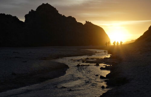
Bringing The Heat
WEATHER STORY
A strong ridge of high pressure will push into the region through mid-week. It will bring an impressive dome of hot air to the state. Coastal temperatures will peak today as this heat noses in, but eventually, our low level onshore flow will win out, keeping the air conditioning on for the coast and nearby valleys. If you live higher in elevation or away from the coast, prepare for about 4-5 days of serious heat!
FORECAST & ALERTS
***HEAT ALERTS***
High pressure over the Four Corners builds westward over Southern California bringing hot temperatures to the Bay Area. Temperatures begin to increase on Tuesday with the hottest day of the week forecast to be on Thursday. Temperatures will slowly diminish into the weekend, but remain warm and dry.
… for the Santa Cruz Mountains, Santa Clara Valley, northern valleys of San Benito County, the northern Salinas Valley, Carmel Valley, and the highway 68 corridor east of Monterey…
**HEAT ADVISORY**
in effect from 11AM Wednesday until 9PM Friday
-Temperatures 92 to 100 expected.
- Hot temperatures may cause heat illnesses to occur.
… for the Diablo Range, the mountains and southern valleys of Monterey & San Benito Counties…
**HEAT ADVISORY**
in effect from 11AM Wednesday until 11AM Thursday
***EXCESSIVE HEAT WARNING***
in effect from 11AM Thursday until 9PM Friday
-For the Heat Advisory, temperatures up to 94 to 99 expected. For the Excessive Heat Warning, dangerously hot conditions with temperatures from 98 to 108 expected.
-Extreme heat will significantly increase the potential for heat related illnesses, particularly for those working or participating in outdoor activities.
-Temperatures will increase on Wednesday, with the hottest day of the week on Thursday. While temperatures reduce on Friday, they will still be hot.
Drink plenty of fluids, stay in an air-conditioned room, stay out of the sun, and check up on relatives and neighbors. Young children and pets should never be left unattended in vehicles
under any circumstances.
Take extra precautions if you work or spend time outside. When possible reschedule strenuous activities to early morning or evening. Know the signs and symptoms of heat exhaustion and heat
stroke. Wear lightweight and loose fitting clothing when possible. To reduce risk during outdoor work, the Occupational Safety and Health Administration recommends scheduling frequent
rest breaks in shaded or air conditioned environments. Anyone overcome by heat should be moved to a cool and shaded location. Heat stroke is an emergency! Call 9 1 1.
Wednesday: Mostly sunny with some thin, high clouds moving through. Much warmer with coastal highs in the upper 60s to low 90s—warmest on the north side of the bay—and mid 80s to 107ºF inland. Northerly winds continue over the hills at times. The sea breeze will burst into the near-coastal valleys in the late afternoon and could be gusty at times.
Overnight: A few high clouds, otherwise clear. Another warm morning in the 50s for most.
Thursday: It will be another warm day on the coast with similar temperatures to Wednesday. High clouds will continue to stream through and some low clouds/fog will be possible on the coast late. Inland areas may be a degree or two warmer than Wednesday’s highs with a range from the upper 80s to around 110ºF! Breezy inland at times, especially in the afternoon.
Extended: Temperatures will begin to cool on Friday—more noticeable on the coast. We’ll drop a couple of degrees per day, returning to seasonal normals on the coast on Saturday. Inland areas will remain hot into the weekend, but will be quite a bit cooler on Sunday. The summer solstice occurs at 8:52PM on Sunday.
-------------------------------------------------------------------------
This week's normal temperatures:
--COASTAL CITIES--
LOW: 52ºF
HIGH: 69ºF
--INLAND CITIES--
LOW: 50ºF
HIGH: 82ºF
----------------------------------------------------------------------------
-The outlook from the Climate Prediction Center for June 23rd – 29th calls for the likelihood of ABOVE normal temperatures and near normal precipitation*.
*Note: little to no precipitation usually falls this time of year.
-El Niño/La Niña STATUS: Neutral
-Forecast into Summer: Neutral
-Area drought status: “Extreme Drought” for the entire viewing area with the far southeastern corner of Monterey County considered “Exceptional Drought”


