Tornado-producing storms are pushing across the South today
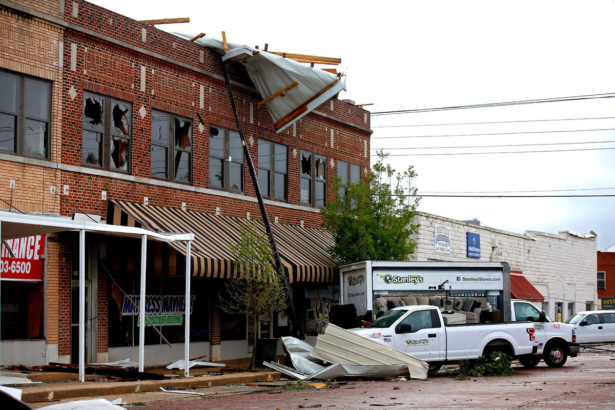
A tornado swept through Seminole
By Judson Jones, CNN Meteorologist
Tornadoes, flash flooding and hail threaten a wide section of the South as they push east Thursday, a day after the same line of severe storms spawned reported tornadoes — snapping power lines, tearing apart buildings and enticing storm-chasers — in Texas and Oklahoma.
An enhanced risk — Level 3 of 5 — for severe storms is forecast across east Texas, southern Arkansas and northwest Louisiana, including Shreveport.
“Damaging wind, hail and a few tornadoes are expected,” the Storm Prediction Center stated.
A slight risk — Level 2 of 5 — surrounds the enhanced risk area and covers nearly 10 million people, including in Dallas and Austin in Texas and Memphis, Tennessee. The same severe impacts threaten these places but with a slightly lower probability of dangerous conditions than those in the enhanced risk zone.
“Scattered severe storms are likely, mainly during the afternoon into early evening across parts of central to east Texas through the Mid-South. Damaging winds should be the primary hazard, but isolated tornadoes and large hail will also be possible,” the prediction center said.
Get ahead of the storm: Sign up for weekly email updates from CNN meteorologists
A tornado watch is in effect until 6 p.m. CDT for parts of northeast and central Texas, southwest Arkansas and northwest Louisiana. Nearly six million people are in the watch area that includes Austin, Waco and Tyler in Texas and Shreveport, Louisiana.
A severe thunderstorm watch has been issued to the east of the tornado watch for southeast Arkansas, northern Mississippi and southwest Tennessee. This watch is in effect until 8 p.m. CDT and includes Memphis. While tornadoes can’t be ruled out in this area, wind and hail will present the biggest threat.
“In addition, heavy rain will be associated with these thunderstorms,” the prediction center said.
This could lead to flash flooding, especially in urban areas and along small streams. Flash flood watches are posted in parts of Oklahoma, Kansas, Missouri and Arkansas through Thursday evening.
Storm-chasers jam roads around tornadoes
Tornadoes spawned by these storms roared Wednesday across an area known for storm-chasing.
Livestreams of tornadoes came in from storm chasers in Texas.
And news stations flying helicopters captured the storms in Oklahoma.
At times, storm chasers jammed roads as they tried to get a glimpse of the catastrophic weather, their livestreams showed.
The storms left electrical lines and buildings damaged in Seminole, Oklahoma.
Southeast and Mid-Atlantic are threatened Friday
By Friday, this storm system will move through the Southeast and Mid-Atlantic, again bringing threats of isolated tornadoes, damaging wind and hail.
An enchanced risk of severe storms — Level 3 of 5 — has been issued for portions of central Alabama and Georgia, including Montgomery, Alabama, and Macon, Georgia.
More than 60 million people will be under the threat of severe storms Friday from the Mid-Atlantic to the Gulf Coast.
A level 1 and 2 out of 5 surround the enhanced risk and include Atlanta, Charlotte, New Orleans and Washington, DC.
The-CNN-Wire
™ & © 2022 Cable News Network, Inc., a WarnerMedia Company. All rights reserved.
CNN’s Taylor Ward contributed to this report.


