Salinas River Near Spreckels has crested, Highway 68 remains open at this time

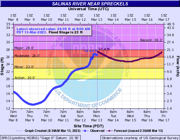
SALINAS, Calif. (KION-TV) - The Salinas River Near Spreckels has crested at 26.89 feet, which is lower than the 27.3 feet projection, according to the USGS. HWY 68 remains open in both directions at this time and was never shut down.

On Monday morning flooding from the Salinas River began causing concern for road closures. The Monterey County Sheriff’s Office has issued a Shelter-In-Place to residents and businesses at Las Palmas 1, 2, and Indian Springs due to flooding at River Rd. All residents and businesses in these areas and not under Evacuation Orders should Shelter-In-Place until further notice.
According to the Office of Emergency Services in Monterey County, floodwaters from the Salinas River have moved northeast towards Spreckels Boulevard and are beginning to impact Spreckels Boulevard near Highway 68. County officials are warning to be prepared for possible road closures.
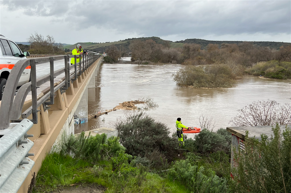
Highway 68 at the Salinas the Salinas River near Spreckles Boulevard is open. There is one lane closed along westbound Highway 68. The number 2 lane is closed due to crews monitoring the Salinas River, according to CHP Monterey.
There have been Waze reports of possible flooding off River Road nearing HWY 68 between River View CT and Las Palmas Road.
According to a statement from the county "The Salinas River can crest at Spreckels/Highway 68 before daylight Monday morning, March 13, and is expected to result in significant flooding of nearby agricultural land and may affect structures and critical infrastructure."
If this sounds familiar, it's because similar concerns were brought up back in the January storms. Back then the river peaked at 24.6 feet according to KION Chief Meteorologist Dann Cianca.
This time the projections are at 28 feet, but with some acknowledgment from the county that the river's activity can be unpredictable.

