All Evacuation Orders lifted in Santa Cruz County
SANTA CRUZ COUNTY, Calif. (KION-TV): UPDATE ON JAN. 17, 2023 AT 1:30 PM: The Santa Cruz County Sheriff's Office announced on Tuesday afternoon that evacuation orders in Chalks Canyon and Pajaro River area have been lifted.
Chalks Canyon has been under evacuation orders since New Year's Eve. Those roads include Chalks Road and Whitehouse Creek Road.
The Pajaro Areas that were lifted in the Santa Cruz County side were Riverside Road, Carlton Road, Coward Road and Marsh Lane.
To see if your neighborhood is still under evacuation orders or warnings click here.
Evacuation orders and road closures issued in parts of Santa Cruz County
SANTA CRUZ COUNTY, Calif. (KION-TV): Evacuation orders have been issued in Santa Cruz County's Felton and Paradise Park area as rain continues to pour and winds sweep through the area.
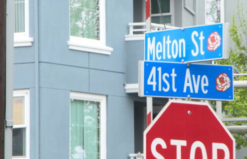
The orders include the Felton Grove area, covering Bridge Road North and South plus River Road neighborhoods up to Graham Hill Road.
As of 6:40 a.m. Monday the Capitola Wharf area has been added to the list of evacuation orders.
It also includes Beth and Gail Drive as well as River Lane.
Paradise Park, which was already hammered by the two previous storm systems, has also been upgraded to an evacuation order along Highway 9.
The Soquel area is also seeing evacuation orders: Soquel San Jose and Porter west to North Rodeo Gulch Drive are being asked to leave. The order includes neighborhoods along Soquel Drive South to Highway 1 and Commercial Way.
Orders are also in place for the Prescott, Glenn Haven and Cherryvale areas.
Freedom Area: Neighborhoods along Freedom Blvd from Buena Vista Avenue north to Corralitos Road and Freedom Lake Park.
Watsonville area order: All Watsonville evacuation warnings have been upgraded to evacuation orders. This includes neighborhoods along Holohan, College, Lakeview and Riverside Roads. Plus East Lake east and southeast to Riverside and River Park. Order also extends from Main Street to Sakata Lane along Riverside.
The Chalk Canyon area has been under evacuation orders since the New Years Eve storm.
A new evacuation warning has been issued for neighborhoods along the San Lorenzo River in the Santa Cruz area. This includes Downtown Santa Cruz all the way to Beach Street.
For a detailed look, visit the county's webpage
Road closures
CAL FIRE CZU also says that the Browns Valley Road Bridge at Via Del Sol has been damaged. The alternate route is Las Colinas Drive.
Highway 9 and Holiday Lane is currently closed due to a slide that spilled on the roadway.
Traffic alert
— CHP Santa Cruz (@CHPscrz) January 9, 2023road closure: SR-9 and Holiday Lane. Slide blocking the roadway. Please avoid the area. pic.twitter.com/6JsAF3DYUg
Santa Cruz County and Watsonville issues evacuation warnings
With the rain coming on Sunday night into Monday morning, The Santa Cruz County Sheriff's Office has issued evacuation warnings for the following areas.
The Sheriff's Office said that residents living in these areas should move to higher ground in case flooding occurs in these neighborhoods.
The City of Watsonville also issued evacuation warnings as well to residents living in flood-prone areas. To click for a complete list of streets in Watsonville that are under evacuation warnings click here.
For a complete list for evacuation warnings that Santa Cruz County Sheriff's Office issued click here.
Santa Cruz County Emergency Operations Center has been activated to monitor road closures and flooding impacts which you can click here.
Evacuation Warnings
Pajaro Area
PAJ-E015- Those areas include north of Calabasas Road, Freedom Boulevard, south of Varni Road, Freedom Boulevard, east of Sunflower Way, Chandler Lane and west of Varni Road, Scurich Lane.
PAJ-E024- This includes north of Buena Vista Drive, south of Freedom Boulevard, east of Briarwood Drive, Freedom Boulevard, Buena Vista Drive and west of Pista Lane, Emme Street, Freedom Boulevard.
PAJ-E026- This includes north of Wagner Avenue, south of Minto Road, Holohan Road, east of Atkinson Lane, Cottage Road, Marigold Avenue and west of East Lake Road.
PAJ-E027- The roads in this area are north of Lakeview Road, Salsipuedes-Pajaro Cycleway, south of Strawberry Hill, Cutter Drive, east of East Lake Avenue, Salsipuedes-Pajaro Cycleway and west of Marsh Lane
PAJ-E028- These roads include north of Village Way, Lakeview Road, Riverside Road, south of Salsipuedes-Pajaro Cycleway, Lakeview Road, east of Condit Lane, East Lake Avenue, Bridge Street and west of Lakeview Road, Riverside Road.
PAJ-E029- Roads include north of San Juan Pass, south of Lakeview Road, Delta Way and east of Riverside Road and west of Riverside Road, San Juan Road.
PAJ-E030- Roads involved in this area include north of Riverside Road, San Juan Road, south of
Carlton Road, Lakeview Road, Peckham Road, east of Riverside Road and west of Carlton Road.
PAJ-E032- This includes north of Crown Road, south of Riverside Road, east of Riverside Road, San Juan Road and west of Murphy Road, Silliman Road, Crown Road.
CRZ-E067- These roads include north of Beach Road, Dairy Road, Pelican Point, south of Zils Road, Buena Vista Drive, east of Sunset Drive and west of San Andreas Road
CRZ- E069- The roads include Salsipuedes-Pajaro Cycleway (Proposed), south of West Beach Street, Industrial Road, Riverside Drive, east of Cabrillo Highway and west of Salsipuedes-Pajaro Cycleway
The rest of the zones impacted are
CRZ-E070, CRZ-E071, CTL E010, E014, E015, E018, E019, E050, E051, CRZ E081, FEL E008, E012.
Check on shelter information in the county here.