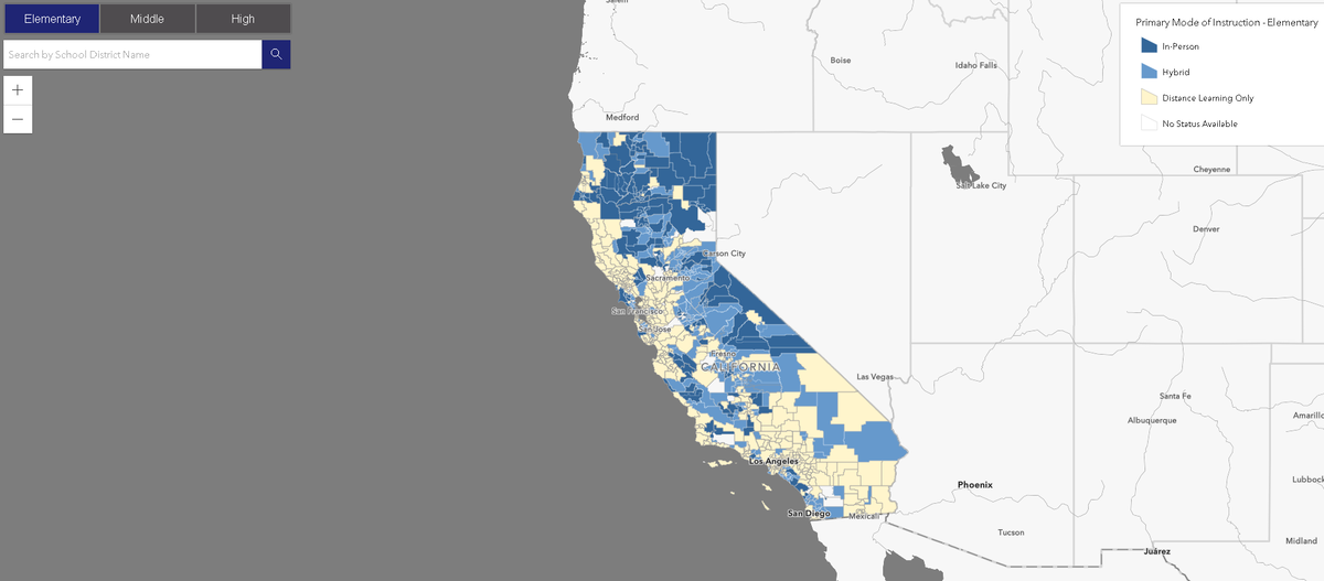
California releases interactive map to show status of school reopenings

SACRAMENTO, Calif. (KION) The State of California launched a new tool Friday to help residents get a look at the status of school reopenings.
Governor Gavin Newsom's Office said the Safe Schools Reopening Map is intended to help communities make data-driven decisions about reopening schools and help with transparency.
“As COVID-19 conditions continue to improve and vaccinations ramp up throughout the state, this map will provide local communities with accessible, up-to-date information on how districts in their communities and beyond are adapting to the pandemic, including safety planning and implementation,” Newsom said. “This map is one of many resources we have made available that will help school staff and families make informed decisions as we safely reopen our schools.”
Newsom said the map was created with the help of county offices of education and the California Collaborative for Educational Excellence.
The map includes all school types, including private and charter, and can be split into elementary, middle and high school. Users can search by school district to see if its primary method of instruction is in-person, hybrid or distance learning only.
When the user clicks on a district, it shows a link to the district's COVID safety plan if there is one, the COVID funds it has received and when it has received PPE.
The California Department of Public Health said it will continue to add data to the map, including information about outbreaks in school districts and whether it has partnered with the Valencia Branch Lab for COVID-19 testing. If the proposal gets legislative approval, it will also display enrollment data.
See the interactive map below.


