I-70 reopens in Colorado after 9-hour closure that stranded drivers as heavy snow and rain inundate Western and Central US

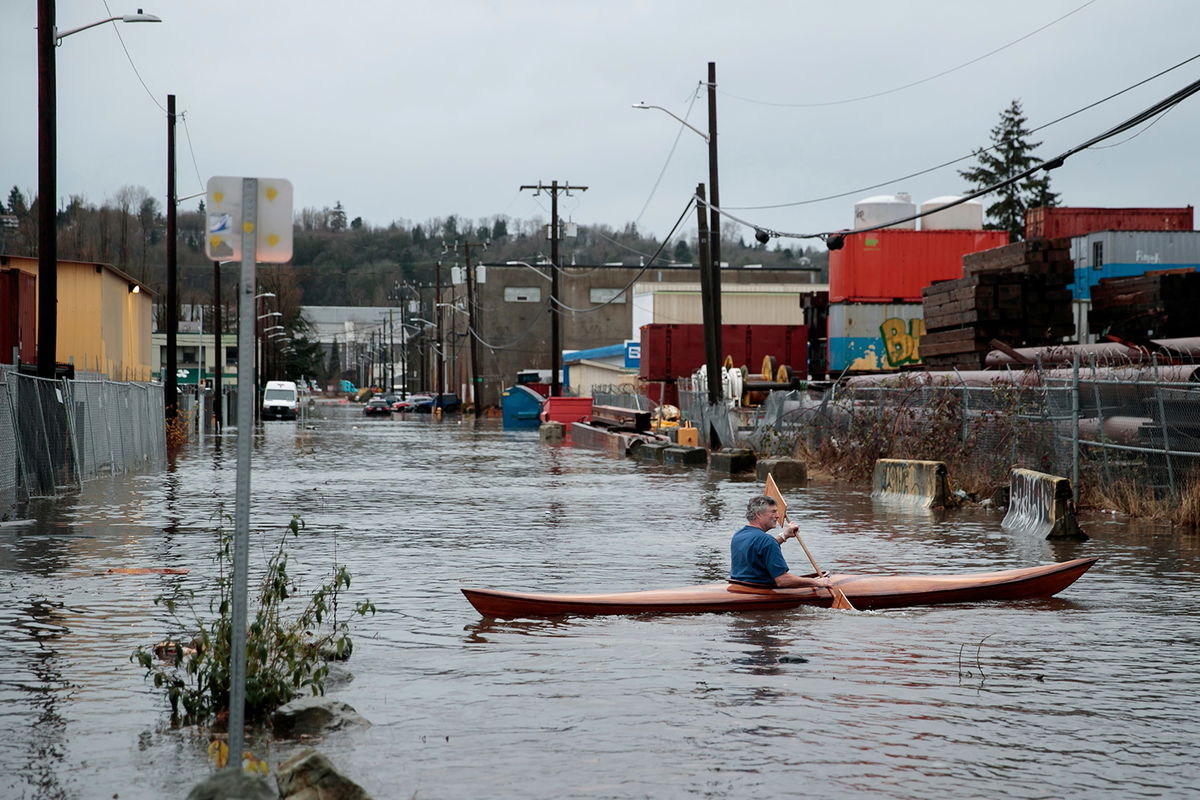
A person kayaks through Seattle's South Park neighborhood on Tuesday
By Rob Shackelford, Elizabeth Wolfe and Monica Garrett, CNN
An eastbound stretch of Interstate-70 in Colorado has reopened, the state Transportation Department said, after a nine-hour closure left drivers stranded amid strong bouts of heavy mountain snow, widespread rain and gusty winds that continue to sweep the West and push into the Central US.
Much of the West is again under winter weather alerts, bracing for the next round after wet and wintry conditions this week flooded roads, blew hurricane-force winds, knocked power out to thousands and killed five people in Oregon.
The storm moved out of Colorado Thursday and into the central Plains, where it is expected to bring wet snow and isolated pockets of rain through Kansas, Nebraska and Iowa into the evening. It then will move through Minneapolis, bringing a mix of rain, snow and ice overnight.
Meanwhile, more than 16 million people in parts of California and Nevada are under flood watches Thursday morning in anticipation of a fresh set of storms along the West Coast in the next couple days. They include San Francisco, Sacramento, Fresno, Oakland and Reno.
In Colorado, the weather prompted the state to announce the safety closure along I-70 near Silverthorne around 8 p.m. ET Wednesday.
“For much of the day yesterday Colorado was above freezing with some light rain, then the rain changed to snow and the roads froze almost instantly,” CNN meteorologist Chad Myers said. “Drivers were caught off guard with the accumulating snow and ice.”
Tractor-trailers got stuck along the interstate, prompting the traffic jams, while other vehicles struggled to get traction on steep inclines, said storm chaser Aaron Rigsby, noting he was was stuck in traffic for over eight hours.
A packed charter bus had to be rescued, and at one point, dozens of vehicles were turned off the road and people slept inside, Rigsby told CNN of what he saw.
“After like four to six hours, you can see a drastic change in the tone of people’s voices and just kind of their demeanor,” Rigsby added. Sentiments went from, “This is kind of cool,” he said, to “How long are we gonna be stuck here,” and “Is there enough fuel?”
Throughout the Denver region, vehicles slid off the icy roads and caused tractor trailers to jackknife, per the CDOT. However, none of the accidents caused by the weather involved fatalities or serious injuries, according to the Colorado State Patrol.
As of Thursday morning, CDOT had around 112 plows working, spokesperson Jared Field said, a force that would cover the Denver area and the I-70 mountain corridor.
More plows were out clearing the roads statewide, but at least one ran into trouble: A plow slid into a ditch and had to be pulled out by another plow, Field told CNN.
Elsewhere, the dangerous conditions Tuesday in Oregon left five people dead, including a 4-year-old girl, after severe weather caused trees to fall on passing vehicles, state police said. Wind gusts in the state exceeded 100 mph in some areas, according to the National Weather Service.
The forceful atmospheric river — a long, narrow region in the atmosphere that can carry moisture thousands of miles — is forecast to continue battering the Western and Central US after the initial round of moisture shifts eastward Thursday.
New rounds of rain and mountainous snow will inundate the coast into Friday before shifting to Southern California and the Southwest through the weekend.
More coastal rain and mountain snow to come
As the initial wave of moisture hovered over Colorado overnight Wednesday, the Denver and Boulder areas saw as much as 2 inches of snow per hour.
More than 9 inches of snow had fallen over Boulder and 7.1 inches were reported at Denver International Airport as of Thursday.
“Heavy snow will accumulate on tree branches and powerlines, possibly causing them to break and lead to power outages. Plan on slippery road conditions. The hazardous conditions could impact the Thursday morning commute,” warned the National Weather Service in Boulder.
Meantime, a new bout of moisture is expected to hit the West coast Thursday morning before a more forceful surge ushers in heavy rain in the evening. That storm system is forecast to remain focused on Northern California, southern Oregon and northern Nevada from Thursday evening through Saturday morning before finally shifting to Southern California and the Four Corners region through the rest of the weekend.
Snowfall across much of the West over the next five days is expected to be between 1 to 7 inches in lower elevation areas and 1 to 2 feet in higher elevation areas. Some isolated areas could see more than 2 feet.
The drought-stricken region is receiving a brief respite as much of central California and northeastern Nevada have already seen up to 2 inches of rain with some higher elevations seeing up to 4 inches. By Saturday, those areas could get another 2 to 4 inches of rain or as many as 6 inches in higher elevation areas.
A slight risk — level 2 of 4 — of excessive rainfall has been issued by the National Weather Service for parts of Northern California over the next several days.
The-CNN-Wire
™ & © 2023 Cable News Network, Inc., a Warner Bros. Discovery Company. All rights reserved.
CNN’s Paradise Afshar and Dakin Andone contributed to this report.