‘It looks like a pretty bad scenario,’ an expert says about today’s extreme fire threat

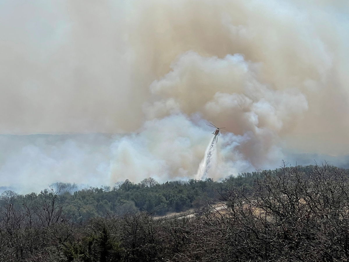
A firefighting helicopter makes a water drop on the Eastland Complex wildfire near Rising Star
By Caitlin Kaiser and Judson Jones, CNN
Following an explosive month of dangerous fire conditions, the Southern Plains are under extreme fire risk again beginning today.
Critically dry conditions, wind gusts of 50+ miles per hour, and highly-receptive fuels across the Texas/Oklahoma Panhandle and into southern Kansas are “setting the stage for exceptionally volatile fire conditions,” according to the Storm Prediction Center (SPC).
“It looks like a pretty bad scenario. The grasses that we have out here in West Texas are about as dry as they can get, which is one of the big factors. And then of course, you get the wind and the very dry and warm air that’s going to be visiting,” Gary Skwira with the National Weather Service (NWS) in Lubbock, Texas told CNN.
Areas across Texas, Oklahoma, and Kansas will be under an extreme fire risk — the highest possible risk — as a low-pressure system moves through.
The threat doesn’t stop there.
“Exceedingly dry conditions will persist through at least Friday,” the NWS office in Amarillo stated, adding high wind speeds could contribute to critical fire danger despite cooler temperatures later in the week.
Check the forecast in your area
The latest stretch of fire risk comes in the wake of a multitude of elevated, critical, and extreme fire weather outlooks the SPC has issued for the region so far this year.
Many places, including areas near Abilene and Fort Worth, Texas, have already been ravaged by fires, with tens of thousands of acres burned.
“A force of nature”
“The fuel environment across the Panhandles is very volatile to fire spread which may lead to large fires on Tuesday if any fires happen to start,” the NWS Amarillo warned.
Once the fires start, they are very difficult to get under control.
“An SPWO [Southern Plains Wildfire Outbreak] event is a force of nature, and much like a hurricane or tornado, it cannot be stopped,” the Texas A&M Forest Service explained.
The wildfires can grow massively in very little time and are difficult to contain, allowing for widespread damage to the landscape.
Fires in the region have accounted for 49% of all the acres burned across the country since 2005, even though they only make up 3% of all reported wildfires, the forest service added.
It highlights the responsibility of those living in fire-prone areas to be aware of the risk and avoid activities that may lead to a wildfire outbreak.
Sign up for weekly weather alerts
“We will most certainly want to do our part and prevent wildfires by exhibiting extreme caution with any outdoor sparks of flames,” the NWS in Amarillo said.
In the event of an emergency, “have multiple means of receiving messages from both the Weather Service and from the local media and authorities,” Trenton Hoffeditz, meteorologist at the NWS Amarillo advised, encouraging those in vulnerable regions to have a “go bag” with necessities such as documents and medications.
Drought and La Niña are major players
“Dry conditions beneath this low pressure system will exacerbate an ongoing extreme drought over the Southwest and Southern/Central Plains,” the Weather Prediction Center (WPC) wrote.
At 26,000 square miles, Texas has more “exceptional drought” area — the most severe drought category — than any other state, according to the US Drought Monitor.
The area of exceptional drought is three times the size of Massachusetts.
“When you get a drought like this, it is pretty difficult to break that cycle, to have a significant change in the weather pattern,” Hoffeditz told CNN.
In addition to long-term drought conditions, we are currently under a La Niña advisory, which adds even more fuel to the fire risk.
“Historically, SPWO events happen more often during La Niña years. This is because La Niña conditions translate to warmer than normal, and drier than normal, conditions for Texas during the winter and spring months. Increasing the potential for high impact wildfire weather and SPWO events,” according to the Texas A&M Forest Service.
This year brings about similar conditions to those seen in 2011, where we experienced extreme drought in conjunction with La Niña conditions.
“We never really had a rain or a thunderstorm season,” Skwira said in reference to the 2011 season, adding it caused the risk of fire weather to continue all summer.
With a 53% chance of La Niña conditions continuing well through August and persistent drought conditions across the Southern Plains, the area may be subjected to a similar continued pattern of fire risk unless more precipitation comes into play.
The-CNN-Wire
™ & © 2022 Cable News Network, Inc., a WarnerMedia Company. All rights reserved.