Timeline shows when storms may form in Southeast Michigan Wednesday night
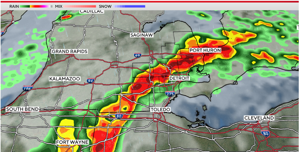
The CBS News Detroit futurecast model places the main line over the region with a risk of severe storms close to 10 p.m.
By Ahmad Bajjey
Click here for updates on this story
DETROIT, Michigan (WWJ) — While rain has been persistent on Wednesday in Southeast Michigan, storms are still possible Wednesday night as a warm front rapidly lifts to the north.
Based on the rate of the front, and any chances for storms to build, arrival of the line seems to come in from the southwest to the northeast at a bit of a slant.
We should see rain again after 8 p.m., with a chance at the line arriving around 8 to 9 p.m.
The eastern parts of our area should see the line by 9 to 10 p.m.
The CBS News Detroit futurecast model places the main line over the region with a risk of severe storms close to 10 p.m., so keep an eye on the forecast.
Strong damaging winds are the primary concern, along with an isolated tornado risk and some flooding due to heavy rain.
The NEXT Weather Team will continue to monitor the risks through the evening.
Please note: This content carries a strict local market embargo. If you share the same market as the contributor of this article, you may not use it on any platform.