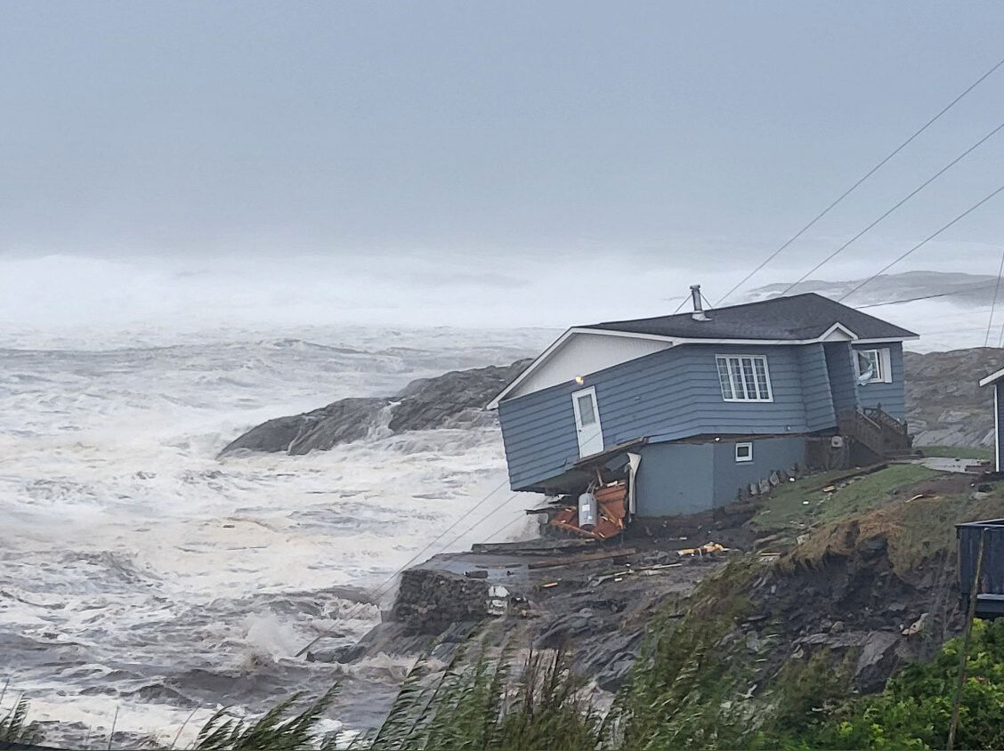
Why Fiona’s rare left hook make it a menace through Atlantic Canada

Hurricane Fiona damaged Wreckhouse Press
By Megan DeLaire, CTVNews.ca writer
Click here for updates on this story
Toronto, Ontario (CTV Network) — There are a few reasons why Fiona is already being labelled a “historical storm” for Eastern Canada, and one is its unusual left hook.
Tracking for the storm released by the National Oceanic and Atmospheric Administration (NOAA) shows that, once it passes the 40th parallel north, its trajectory appears to veer slightly left, taking it straight to Nova Scotia and Prince Edward Island.
Bob Robichaud, warning preparedness meteorologist with the Canadian Hurricane Centre, doesn’t see this path changing.
“The track of the storm remains pretty much the same as what we’ve been talking about the last few days,” Robichaud said in a virtual media briefing on Friday.
“The storm is expected to make landfall in eastern Nova Scotia. But… the impacts are going to be felt way beyond where the centre of the storm actually goes.”
What makes this storm path unusual, experts say, is that hurricanes moving north from the subtropics usually veer east, away from the coast, when they hit the mid-latitudes, which are between the 30th and 60th parallels north.
This is due to the Coriolis effect. The NOAA describes the Coriolis effect as the way Earth’s counterclockwise rotation causes weather events travelling over a large distance, such as storms, to appear as if they’re veering to the right in the Northern Hemisphere and to the left in the Southern Hemisphere.
As the NOAA explains, closeness to the equator determines the forward speed. Near the poles, the Earth rotates more slowly. Near the equator, it rotates more quickly. Because of this, weather systems moving north from the equator track toward the east because they’re travelling from the faster-moving equator up to the slower-moving northern hemisphere.
A graphic by the U.S. National Hurricane Center shows the probable five-day path of Hurricane Fiona. Just above the 40th parallel north, the storm track veers slightly left on its trajectory north. (NWS National Hurricane Centre) In the case of Fiona, however, the Weather Network reports an intense upper level trough is forcing the storm left, or west, in spite of the Coriolis effect.
Although the curve doesn’t appear severe, it’s significant compared to the eastern curve a hurricane would normally take.
The Canadian Hurricane Centre reports Fiona’s centre will land directly over eastern Nova Scotia late on Saturday morning, at which point it will be classified as a powerful sub-tropical storm. Hurricane Sandy, to which this storm is already being compared, followed a similar track in October 2012 when it veered into New Jersey and New York. In New York City, that storm resulted in the deaths of 44 residents and an estimated $19 billion in damages and lost economic activity.
Another factor contributing to Fiona’s projected severity is water temperatures off the east coast, according to AccuWeather. Hurricanes are usually weakened by progressively colder waters as they reach the North Atlantic. This year, however, water temperatures in the North Atlantic, particularly south of Atlantic Canada, are running about 6 C to 11 C higher than average.
“Those warmer-than-usual waters may result in less weakening of the hurricane or a slower transformation to a rainstorm,” AccuWeather reported Thursday.
Fiona is expected to bring dangerous winds, heavy rain, large waves and storm surges to Atlantic Canada. Impacts are likely to include prolonged utility outages, wind damage to trees and structures, coastal flooding and possible road washouts. Parts of Nova Scotia could receive more than 150 mm of rain by Sunday.
“We expect landfall on Saturday morning as a very powerful post-tropical storm, and from landfall that storm is going to move once again towards the north east,” Robichaud said. “As of Friday afternoon, (Fiona) remains on track to be an extreme weather event here in Eastern Canada.”
Government officials say people should prepare for the storm by securing outside items, trimming dead branches to reduce the danger of these falling and stocking up on water, ready-to-eat food, heating fuel, flashlights and radios, extra batteries and other emergency supplies.
Please note: This content carries a strict local market embargo. If you share the same market as the contributor of this article, you may not use it on any platform.
CTVNews.cactvnews.caproducers@bellmedia.ca