It’s been four weeks since the last named Atlantic tropical system, but peak season is just around the corner

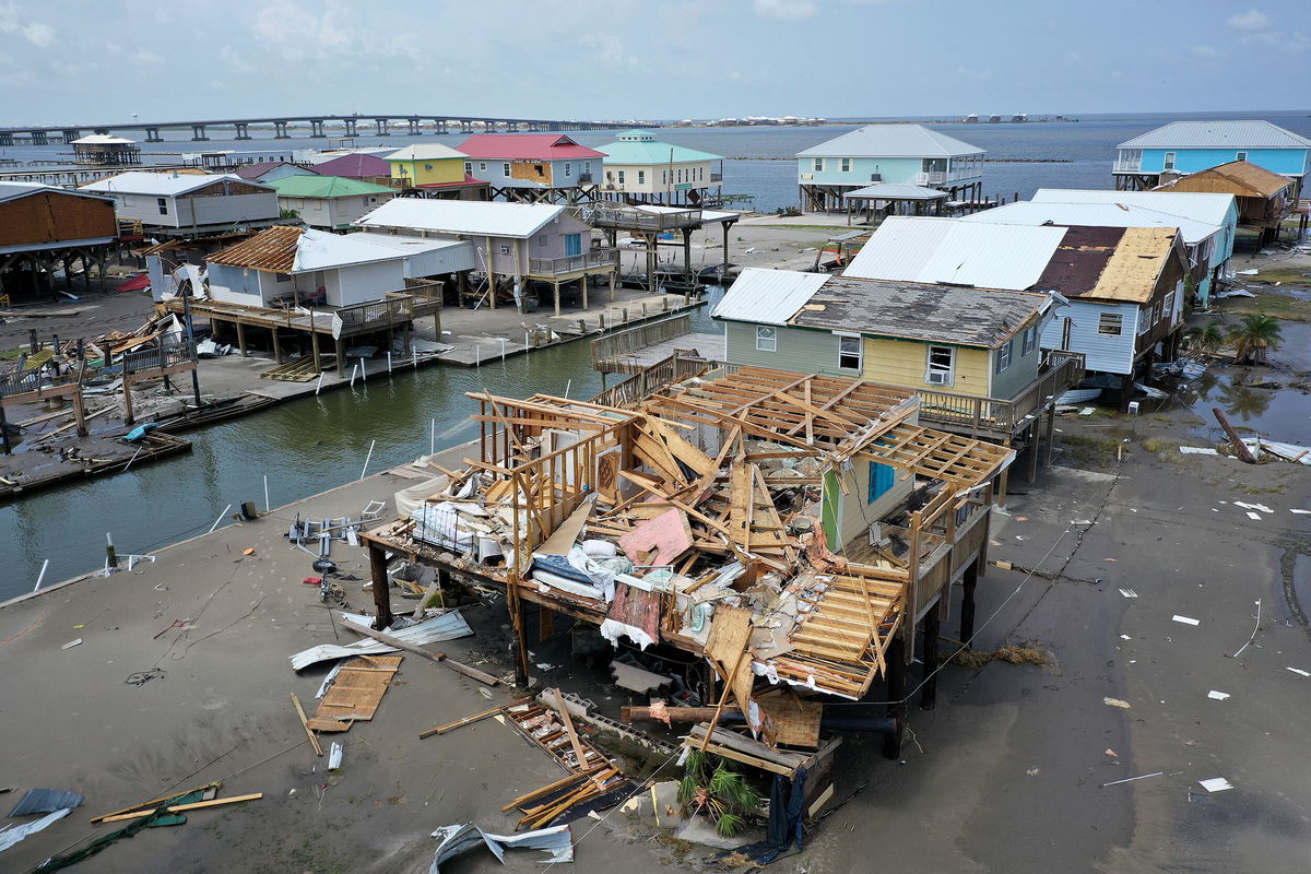
Homes in Grand Isle
By Jennifer Gray, CNN Meteorologist
We’ve now entered month three of hurricane season, which is more than 30% of the way through, and it seems like we are getting a slow start. People have even asked me where it was, or even commented they thought this season was supposed to be busy.
So, I asked a hurricane expert.
“You’re right! It sure has been quiet in the Atlantic lately,” said Phil Klotzbach, research scientist at Colorado State University, in an email to CNN. “We had a brief flurry in late June/early July with Bonnie and Colin, but it’s been dead since then.”
And you may not even remember those two storms, especially Colin in early July. If you blinked, you missed it. Colin formed over land in South Carolina and only survived about 24 hours.
But let’s not write hurricane season off just yet. If you have vacation plans during the next couple weeks, you should be in the clear — however, we should start to see things slowly (or quickly) change soon.
“There are signs that things should pick up as we head towards mid-August,” Klotzbach noted.
One reason we have had a quiet few weeks is thanks to dry air coming from Africa.
“This dry air suppresses thunderstorm activity which is necessary for thunderstorm complexes moving off of Africa to thrive and grow into hurricanes,” Klotzbach explained. “Dry air is pretty common in the tropical Atlantic at this point during the season.”
Many times, dry air outbreaks are associated with the Saharan dust you hear us talk about quite a bit this time of year. The dry air carries the dust across the Atlantic and can reach the US. It can cause respiratory problems in some but also provide glowing sunsets and sunrises.
“Typically, by the time we get into mid-August, strong dust outbreaks (and associated dry air) tend to subside, and the tropical Atlantic becomes more conducive for hurricane formation,” Klotzbach added.
Our sense of ‘normal’ has been shaken
It’s also easy to lose sight of what is even considered normal now. Both 2020 and 2021 were extremely active seasons early on. 2020 had 30 named storms for the entire season and was already on the I-named storm (Isaias) at this point in the season, steamrolling right through the entire alphabet and a portion of the Greek alphabet too.
Last year exhausted all the hurricane names for the second year in a row, which has never happened before and marked the sixth consecutive “above normal” hurricane season.
So, it is not surprising we are starting to scratch our heads about why nothing much has happened during the last few weeks. But 2021 did have a bit of a break during this time period as well, where nothing formed between July 9 and August 11, which is very reminiscent of this year.
Klotzbach also pointed out while El Niño and La Niña are big seasonal drivers of how the season should play out, there are other phenomena driving shorter-term variability.
“The Madden-Julian oscillation can either increase or decrease Atlantic hurricane activity,” Klotzbach emphasized. “The MJO is deep thunderstorm activity that propagates around the globe every about 30-60 days. As it does so, it can alter levels of vertical wind shear and midlevel moisture.”
It has been another contributing factor to the lack of activity during the last month, because the oscillation has prohibited thunderstorm development over Africa.
Thunderstorms in western Africa tend to push west into the Atlantic, becoming the building blocks of tropical development.
The season isn’t dead
While it has been a nice break from hurricanes this month, Klotzbach is confident the tide will turn.
“The models are generally forecasting a more conducive pattern for the Atlantic by the time that we get to the middle of August,” Klotzbach reported. “Air is forecast to more consistently rise over Africa and sink over the tropical Pacific. This pattern should result in reduced vertical wind shear.”
It means we will see an environment ripe for hurricane development, right on cue.
“The average first Atlantic hurricane forms on August 11 and historically, 90% of major hurricanes form after August 20,” Klotzbach stated.
The National Oceanic and Atmospheric Administration and Colorado State University are both putting out their updated hurricane forecasts for the season Thursday, so be sure to check back and see if the numbers go up, down or stay the same.
Also, Vice President Kamala Harris is traveling to the National Hurricane Center in Miami today, where she will “receive a briefing on climate resilience as communities face climate risks including hurricanes, floods, drought, extreme heat, and wildfires,” according to the White House schedule.
The-CNN-Wire
™ & © 2022 Cable News Network, Inc., a Warner Bros. Discovery Company. All rights reserved.
CNN Meteorologist Haley Brink contributed to this story.