The most active spring severe and southwest wildfire season in years

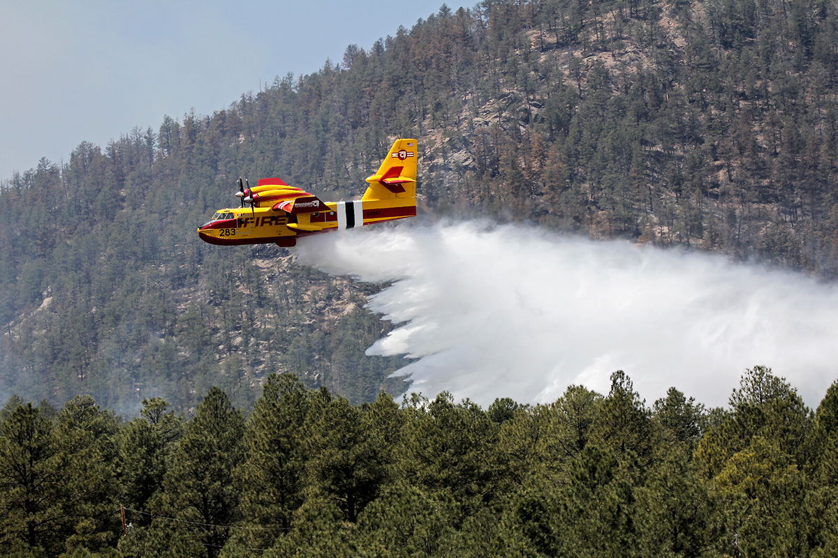
In this photo released by the U.S. Forest Service
By Judson Jones, CNN meteorologist
May and June mark the peak of tornadic weather in the US. It is also the peak of wildfire season in the Southwest.
And it’s all connected.
Storm systems deliver moisture and instability in the Plains to create tornado-producing storms, and at the same time provide dry air and gusty winds into the Southwest, creating critical fire conditions.
It’s unclear exactly what will happen in the next two months, but it doesn’t look good based on current trends.
It has been one of the more active springs the US has seen in terms of severe storms compared to the past several years, Bill Bunting, Chief of Forecast Operations at the Storm Prediction Center, told me this morning.
And in terms of wildfire activity, April had some of the worst consistent fire weather conditions seen in New Mexico since 2011.
Nearly every day this week, we will see severe storms in some areas and critical fire danger in others, a pattern expected to continue through May and even well into June.
“Most of the Southwest is forecast to have above-normal significant fire potential in May and June,” the National Interagency Fire Center stated in its Wildland Fire Potential Outlook.
It is “a persistent pattern of very dangerous fire conditions,” Bunting said.
“Day after day.
“Week after week.
“We’ve had nearly continuous red flag warnings,” David Craft, a meteorologist with the National Weather Service in Albuquerque, New Mexico, told me Monday morning.
“We issued as many red flag warnings in April as we did in 2011,” he noted, which was the last extremely active year for wildfire weather conditions in his region.
Red flag warnings are issued when the humidity levels are low enough and winds are strong enough for explosive fire growth.
More warnings are issued today and will likely be most of the week. On Thursday and Friday, there may be a slight reprieve, but conditions worsen again over the weekend.
The largest fire burning in New Mexico, the Calf Canyon and Hermits Peak fire, is especially concerning today as extreme winds shift out of the northwest. The wind change will push the fire dangerously close to the town of Las Vegas, New Mexico.
“It’s affecting a lot of people,” Craft observed.
As I talked on the phone with him, he used his computer to zoom in to the town.
There are a lot of structures in the evacuation area, he pointed out.
It is obviously a concern to meteorologists like Craft when they know the conditions, know the forecast, and see people in the path of the predictions.
He added even if your house doesn’t burn, almost everyone in this area will be dealing with the smoke. It will likely reduce visibility on the roadways in the region, including busy Interstate 25.
Read more: ‘Refusal to evacuate could be a fatal decision’
Dire wildfire conditions are likely to continue this week and through May and June.
Craft noted May and June are usually the peak for wildfire weather conditions, but dry weather and strong winds can last well into July in northern New Mexico.
It all depends on when the Southwest monsoon kicks in and delivers moisture to the region. He finished our phone call hopeful we will see the monsoon come early like we did last summer.
But the reality looks a little grimmer.
“We have another two months of critical fire conditions that we are going to be seeing,” he confirmed. So, “keep your sparks to yourself.”
It leaves Bunting worried about something completely different:
Warning fatigue.
“It’s important for the fatigue not to set in,” he cautioned.
With so many warnings, people might stop listening to the message, and the message of potential fire danger is as important as severe storms.
The most active spring severe weather season in years
The last few years have seen a relatively quiet severe storm spring season.
“This year looks like it will be a change of pace,” Bunting projected.
Day to day, things may look different, but the overall pattern shows all the key ingredients needed when forecasting severe storms.
“Right now, we’re probably at the peak of our tornado season,” Pete Snyder, a meteorologist with the National Weather Service in Tulsa, Oklahoma, told Chad Myers. “We’re most likely to see the strongest storms that produce tornadoes.”
Tulsa is one city under the threat of severe storms this afternoon. There is a moderate risk, Level 4 of 5, in northeastern Oklahoma.
To the west of Tulsa is the greatest threat of tornadoes and in Tulsa itself, winds gusting to hurricane-force (74+ mph) are possible.
“Intense severe thunderstorms are expected across portions of northern Oklahoma and far southern Kansas, mainly between about 3 to 11 PM CDT” the Storm Prediction Center said in its outlook.
The highest likelihood of significant tornadoes will be during the earlier hours, when the discrete “supercells” will be prevalent in the region. By later in the evening, the cells will transition to a squall line, with the potential for damaging wind gusts of 75 mph or greater.
And today is not the only day under threat. The pattern continues with more severe storms in Kentucky and Ohio on Tuesday.
Then the severe storm threat will shift back across the southern Plains Wednesday. And finally, Arkansas, Mississippi and Tennessee will see their changes increase on Thursday.
“We are just beginning May, and May and June are the busiest months for severe weather,” Bunting emphasized.
The-CNN-Wire
™ & © 2022 Cable News Network, Inc., a WarnerMedia Company. All rights reserved.