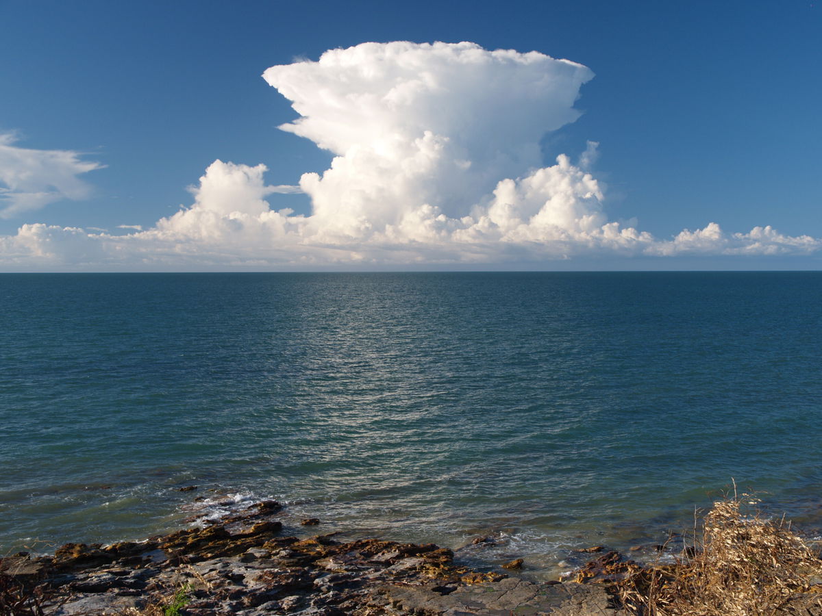
Hector arrives promptly at 3pm. But Hector isn’t a person

Looking north from Darwin
By Allison Chinchar, CNN Meteorologist
As March came to an end, so, too, did Hector. At least until warmer, more favorable weather returns.
Nearly every afternoon from September to March, a thunderstorm develops over the Tiwi Islands in northern Australia. In fact, it happens so regularly, the Bureau of Meteorology actually refers to it by name — Hector. At 3 o’clock in the afternoon, people are known to line the shores of Darwin, a city over 100km (62 miles) away, just to snap pictures of the storm forming.
Hector is not just any common thunderstorm, though; it is a very specific, very singular one.
“Hector, or sometimes “Hector the Convector,” is known as one of the world’s most consistently large thunderstorms, reaching heights of approximately 20 kilometres (66,000 ft),” said Ian Shepherd, senior meteorologist at the Australian Bureau of Meteorology.
From a distance, Hector will have billowing white clouds with great vertical development. The top of the clouds will have an anvil or mushroom shape, and can reach several thousand feet (over 1000 meters) high.
“Southeasterly trade winds extending from the subtropical ridge to the south will normally suppress thunderstorm activity over much of the Northern Territory during the late dry season (September) and at times early in the wet season (October and November), leaving Hector as a prominent but isolated feature on the Darwin skyline,” Shepherd said.
But Hector can’t just form anywhere since it needs very precise meteorological conditions in order to form so consistently. Those ideal conditions exist in the Tiwi Islands, which consist of two main islands (Bathhurst Island on the west and Melville Island to the east) and several much smaller, uninhabited islands.
“The size, shape and location of the Tiwi Islands make them a perfect place for Hector to develop,” said Ben Domensino, meteorologist with Weatherzone, a DTN company. “Sea breezes develop over the islands from all sides and meet in the middle. These converging winds, which are carrying moisture from the surrounding sea, have to go somewhere when they clash … so they go up. This rising column of air becomes cooler with height, which causes water vapour to condense into liquid droplets, forming clouds.”
The islands sit just off the northern coast of Australia in the Timor Sea and are surrounded by a tropical marine air mass on all sides.
“The tropical atmosphere is almost always primed for thunderstorm formation during the wet season when the converging sea breezes provide the lifting trigger,” Shepherd with the Australian Bureau of Meteorology says.
This is very similar to what happens in Florida during the summer months. Warm temperatures heat the land, which — in contrast with cooler ocean temperatures — creates sea breezes. As that sea breeze moves across land, it triggers pop-up thunderstorms in the area. But, unlike the Tiwi Islands, Florida’s topography is not ideal for thunderstorms to develop in the same location at the same time every single instance.
Shepherd points out that while Hector is most common during the warming months of the “build up season” of September-December — remember summer is December to February in the Southern Hemisphere — Hector can also occur during the “rainy season” from January to March. Sometimes Hector lingers into April if temperatures remain warm enough.
Rainy season really means a lot of rain in this area and Hector is responsible for most of it. For Pirlangimpi Airport, located on the Tiwi Islands, the average annual rainfall is right around 2,000mm (80 inches). Roughly 30km east, the town of Milikapiti sees an annual average of 1,600mm (63 inches). That’s more rain than New York City, Amsterdam, and Sydney each see in a given year, and double what London and San Francisco see annually.
But Shepherd cautions that if there is an active westerly monsoonal flow, Hector is less likely to occur.
Monsoonal flow simply refers to when there is a seasonal shift or change in the direction of the wind between land and an adjacent body of water.
“Cloudy conditions and strong westerly winds associated with an active monsoon tend to suppress sea breezes over the islands, reducing the likelihood of Hector forming regularly,” Shepherd said. “An active monsoon also generates regular showers and thunderstorms which move rapidly across the islands from west to east in the relatively cool maritime airstream.”
These regular showers and thunderstorms can inhibit the development of another storm, in this case Hector.
The most suitable conditions for Hector to develop occur when skies are clear with light winds, which allows not only for strong solar heating, but also the formation of daytime sea breezes.
In the winter months (May to August in the Southern Hemisphere) Hector does not occur because cooler temperatures decrease the strength of localized sea breezes and limiting the convergence of winds needed to create Hector.
Why Hector?
Pilots and mariners at work during World War II coined the nickname of Hector, Domensino said.
“The name stuck and it has now become one of the most well-known individual thunderstorm clouds in the world,” he said.
Due to Hector’s consistent timing, the folklore continues that airline pilots and boat captains have been known to use it as a navigational guide.
“The story goes that pilots and mariners used Hector as a point of reference for navigation during World War II because it was so large and reliable, developing every day and over the same place. Even today, it can be used as a directional reference for anyone flying or traveling across the Timor Sea or western Top End.” said Domensino.
With the Australian winter (summer in the northern hemisphere) arriving soon, Hector will likely disappear for a while. But just like with leaves changing colors in the autumn, or snow falling in the winter, “Hector season” will return like clockwork, come September.
The-CNN-Wire
™ & © 2022 Cable News Network, Inc., a WarnerMedia Company. All rights reserved.