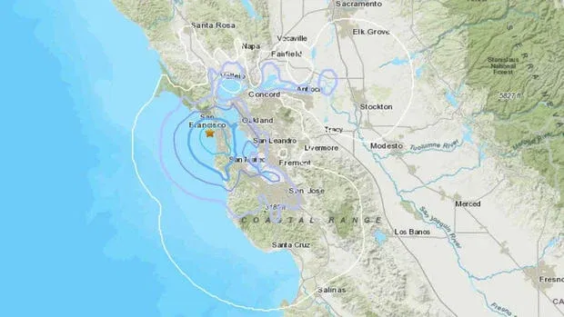
3.7 magnitude earthquake shakes San Francisco Bay Area

SAN FRANCISCO, Calif. (KPIX) - The Bay Area was rattled by an earthquake Friday morning that struck just off the coast of San Francisco.
The 3.7 magnitude quake struck at 7:02 a.m. off the coast of San Francisco, with its epicenter about five miles southwest of the Golden Gate Bridge and two miles west of the Great Highway, according to data from the U.S. Geological Survey.
The earthquake struck on the San Andreas Fault, which runs from the Cape Mendocino region north of the Bay Area to Baja California, Mexico.
The 6.9 magnitude Loma Prieta Earthquake in October 1989 was the most recent major quake associated with the San Andreas Fault. according to the USGS. That earthquake struck in the Santa Cruz Mountains on a fault that formed as a result of a bend in the San Andreas Fault, the USGS said.
The 7.9 magnitude San Francisco earthquake in April 1906 was the most recent great earthquake on the San Andreas Fault, with an epicenter now estimated to be offshore about 2 miles west of San Francisco, according to the USGS.