A new atmospheric river slams flood-ravaged California, threatening landslides and forcing more residents to flee
Originally Published: 14 MAR 23 02:37 ETUpdated: 14 MAR 23 15:36 ETBy Nouran Salahieh, Holly Yan and Joe Sutton, CNN
(CNN) -- Another atmospheric river is walloping storm-ravaged California, inundating cities already flooded by recent rain and forcing residents to flee -- or risk not getting help if they need it.
About 30 million people across the state were under flood alerts as the 11th atmospheric river to hit the West this season slammed Northern California on Monday and took aim at central and Southern California on Tuesday.
"We weren't expecting it to be as bad as we're seeing it," Monterey Mayor Tyller Williamson said.
Rain could fall as fast as 1 inch per hour in some places -- which could result in significant flash flooding. The two areas of most concern are along the central California coast between Monterey and Santa Barbara counties, as well as parts of the Sierra Nevada foothills near Fresno to Bakersfield.
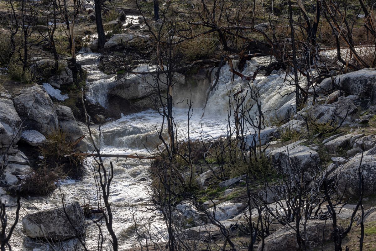
Many parts of California haven't recovered from last week's deadly atmospheric river -- a long, narrow band of moisture that can carry saturated air thousands of miles like a fire hose.
Heavily saturated soil can't soak up much more water, and melting snow could amplify dangerous flooding.
"The forthcoming rainstorms cause concerns of localized flooding impacts to already damaged infrastructure and increased potential for debris flows and mudslides," the Los Angeles County Office of Emergency Management told CNN.
Evacuation alerts are underway for residents in several counties:
• Santa Barbara County issued an evacuation warning Monday night for southern parts of the county and said it planned to upgrade the alert to an evacuation order on Tuesday. Those who refuse to heed the order might be on their own if they get trapped, the county warned.
"BE PREPARED to sustain yourself and your households for multiple days if you choose not to evacuate, as you may not be able to leave the area and emergency responders may not be able to access your property in the event of road damage, flooding, or a debris flow," the county said in a written notice.
• The Santa Cruz County Sheriff's Office issued an evacuation order Tuesday for parts of the county. "An evacuation order means you should leave immediately," the sheriff's office warned.
• An evacuation alert was issued for parts of Monterey County, where residents along the Salinas River were ordered to flee.
• In Los Angeles County, "Due to increased potential for debris flows and mudslides, the County has issued several evacuation warnings in unincorporated areas of Los Angeles County that have burn scarring from recent wildfires," the office of emergency management said.
More than 600 Californians have taken refuge in 32 shelters across 13 counties, the California Governor's Office of Emergency Services said.
'Extensive street flooding is likely'
Los Angeles County is the nation's most populous county, with about 10 million residents. But some of those residents could find their neighborhoods under water.
"Heavy rain and excessive runoff may result in dangerous flooding of rivers, creeks, streams, and other low-lying and flood-prone locations," the National Weather Service's local office said.
"Extensive street flooding is likely. There may be mudslides and rockslides, especially in and near steep terrain."
Across California, 40 of the state's 58 counties were under a state of emergency. Crews positioned across the state are bracing for more overflowing rivers, floods, mudslides and impassable roads.
A wave of life-threatening flooding is likely along much of the coast, central Valley and Sierra Nevada foothills, the National Weather Service said.
The "high-impact" atmospheric river was expected to thrash Southern California on Tuesday afternoon before starting to taper off Wednesday, forecasters said.
A levee breach widens, threatening more flooding
Crews are racing to patch up a broken levee in Monterey County that was breached Friday by the swollen Pajaro River -- forcing thousands to evacuate as water flooded the nearby community.
"It was 120 feet when the levee initially broke, and now it's expanded to 300 feet," the mayor of Monterey said Monday.
Engineers are focusing on short- and long-term fixes. "The situation is dynamic and evolving," said Jeremy Arrich, manager of the division of flood management for California's Department of Water Resources.
For now, crews are trying to use a temporary rock-and-sand wall to slow the flow of water into Pajaro.
"A permanent fix will be undertaken once this crisis has passed," Monterey County officials said.
Aside from the Pajaro River, the bloated Salinas River "is looking at breaching one of the major highways that folks use to get to the (Monterey) Peninsula," said Williamson, the Monterey mayor.
It's not clear how badly Highway 68 will get hit. But some Monterey Peninsula residents could soon find themselves on a virtual island, cut off by floodwater.
'A whole hell of a lot of water' packed in snow
This new wave of storms is pummeling areas already buried by heavy snowfall from the past two weeks.
Now, snowmelt could exacerbate flooding in the Sierra Nevada, where there's likely 3 to 5 feet of snow at elevations higher than 7,500 feet, the National Weather Service said.
During the last storm, the deep snowpack generally absorbed more water than it melted, UCLA climate scientist Daniel Swain said.
"There is more snow water in the southern and possibly central Sierra than there has ever been at this time of year -- and possibly at any point during the year, especially in the southern Sierra," Swain said.
"So there is a whole hell of a lot of water up there right now stored in the snowpack."
Yet another atmospheric river is on the way
After this system, another atmospheric river is expected to hit the West Coast next week.
"Heavy rain, melting snowpack, saturated soils, and swollen streams may lead to prolonged flooding concerns and the potential for shallow landslides in some areas of California," the National Weather Service's Weather Prediction Center said.
"High winds could lead to coastal erosion and may exacerbate localized flooding."
From severe flooding to long droughts, water-related disasters have intensified over the past two decades as global temperatures climbed to record levels, new research shows.
Across the country, another major winter storm is walloping the Northeast. Widespread, heavy snowfall is forecast from northeast Pennsylvania through much of New York state and New England.
The Air Force Reserve "Hurricane Hunters" are flying missions in both the atmospheric river on the West Coast and the nor'easter on the East Coast, collecting data to help improve the forecast for those regions impacted by the storms.
Until the last few years, forecasters had to rely solely on satellites and forecast models for forecasting atmospheric rivers -- which can become very muddy without truly knowing what's happening inside the storms.
Now, the University of California, San Diego, the Scripps Institution of Oceanography and the Center for Western Weather and Water Extremes have teamed up with the Hurricane Hunters, who are able to drop instruments called "dropsondes" inside an atmospheric river to relay pinpointed live weather data.
The information is immediately put into weather forecast models, which drastically improves the accuracy of the forecast.
The-CNN-Wire
™ & © 2023 Cable News Network, Inc., a Warner Bros. Discovery Company. All rights reserved.