New concerns Salinas River flow “may cause significant flooding West of Salinas”
MONTEREY COUNTY, Calif. (KION-TV) -- While evacuation orders continue to increase for homes and businesses along the Salinas River, there's new concerns that some flooding may occur which will flow over Highway 68.
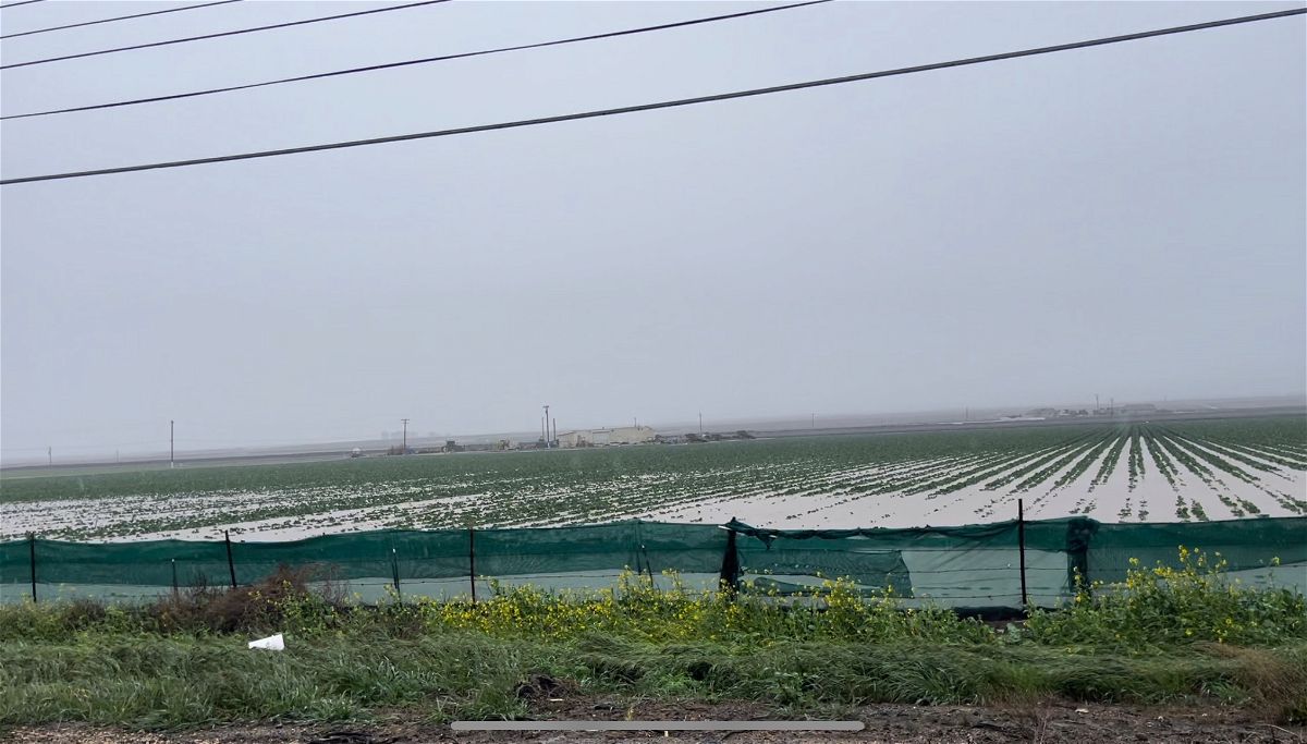
According to a statement from the county "The Salinas River can crest at Spreckels/Highway 68 before daylight Monday morning, March 13 and is expected to result in significant flooding of nearby agricultural land and may affect structures and critical infrastructure."
If this sounds familiar, it's because similar concerns were brought up back in the January storms. Back then the river peaked at 24.6 feet according to KION Chief Meteorologist Dann Cianca.
This time the projections are at 28 feet, but with some acknowledgement from the county that the river's activity can be unpredictable.
But what does the river peaking at 28 feet look like exactly?
According to some information on the National Weather Service webpage, here's what it could mean at various stages:
- 26 feet: The lower portions of Soledad, Gonzales, Chualar, Spence and Spreckels will have moderate flooding. At least 20,000 acres of farm land in the Salinas Valley are threatened with flooding. Levees along the lower Salinas River could breach. Some primary and many secondary roads along the Salinas River will begin to flood. Highway 68 will become inundated.
- 27 feet: The lower portions of Castroville will begin to flood. Foster Road, one mile south of Salinas will flood. Highway 156 near Castroville will begin to flood. Many secondary roads in the Salinas Valley will be flooded and impassable. Large areas of agricultural land in the Salinas Valley will have major flood damage.
- 28 feet: The lower portions of Soledad, Gonzales, Chualar, Spence, Spreckels and Castroville will have major flooding. Major flooding will affect 40,000 acres or more of agricultural land in the Salinas Valley. Some primary roads and most secondary roads in the Salinas Valley will be flooded and impassable.
- 29 feet: All roads just south and west of Spreckels will be flooded. US 101 will flood just north of Soledad. Highway 1 just south of Castroville near Nashua Road will flood. Many roads, homes and agricultural land areas in the Salinas Valley will have major flood damage.
- 30 feet: The entire lower Salinas Valley will have disastrous flooding. The entire city of Salinas is in danger of flooding. Most of Castroville will flood. All roads near the Salinas River will be flooded and impassable. 90,000 acres or more of agricultural land in the Salinas Valley will have disastrous flooding.
You get the idea...though currently the river sits at 23.42 feet.
For a stronger indication of the concern the county has, evacuation orders are in place for many homes and businesses along the Salinas River from just north of King City all the way up to Marina and the Salinas River State Beach.
Given the information, the county is hoping people can prepare for the worst should intense flooding take place over the next couple of days.
Especially after the horrific flooding seen in the Pajaro area over the weekend.